Main content blocks
Skip Welcome to the course!Welcome to the course!
Section outline
-
The e-learning course "Data sharing and digitalization in the water sector" aims to increase awareness of water practitioners, government officials, and university students in the field of water governance on the role of digitalization
About this course
The e-learning course on "Data sharing and digitalization in the water sector" equips water professionals, policymakers, and development practitioners with the knowledge and skills to harness digitalization for better water governance. Digitalization tools in the water sector enhance transparency and accountability in water management, contributing to strengthened transboundary water co-operation.
The course provides the knowledge and skills to strengthened dialogue and co-operation around transboundary water bodies and enhanced knowledge of the role of digital tools in transboundary water resource management, to highlight the importance of data and information exchange for the effective management of water and provide an overview of current and available mechanisms to understand and measure water conditions as a means to promote cooperation, peace and regional integration.
By the end of the course, the participants will have the overview of digital tools to enhance transboundary water cooperation and get acquainted with data-sharing frameworks that improve water cooperation.
Requirements
Everyone, regardless of previous education, can take part in this course. The course is particularly useful for water practitioners, policymakers, and university students with a keen interest in water management and its interlinkages with digital tools.
-
Course staff and contributors
-
Acknowledgements
©️ 2025 Organization for Security and Co-operation in Europe (OSCE)
Opinions, interpretations, and conclusions expressed in these podcasts and videos are the personal views of the individuals and do not necessarily represent the views of the OSCE, its participating States, or its donors.
The hosting of these podcasts and videos on an OSCE or OSCE-affiliated website or platform does not imply an endorsement of them, their content, or their contributors/creators, nor does the involvement of individuals in the podcasts and videos imply an endorsement of them or any entity they represent.
Furthermore, the use of embedded content from third-party websites does not imply an endorsement of the content or the third-party, and the OSCE does not assume any liability for third-party content or websites.
These podcasts and videos are for educational purposes. The OSCE does not assume any liability or make any representations or warranties regarding the content therein.
The OSCE owns the copyright in these materials and has granted licences to its partners for agreed uses. Third parties may reproduce, distribute, adapt or otherwise exploit these materials only under licence from the OSCE. Please send any requests to the OSCE in writing in advance.
The designations employed and the presentation of material in this e-learning do not necessarily constitute or imply the expression of any opinion on the part of the OSCE concerning the legal status of any country, territory, city, or area, of any authority therein, or concerning the delineation of any frontiers and/or boundaries.
Course management: Office of the Co-ordinator of OSCE Economic and Environmental Activities
Course development: Geneva Water Hub, UNESCO Chair on Hydropolitics at the University of Geneva.
We would like to extend our gratitude to colleagues from the University of Geneva Audiovisual Services, especially Jesus Manuel Gonzalez and Manu Zirnheld, who contributed to the development and review of this course.
Organizational, project management support, and review: Office of the Co-ordinator of OSCE Economic and Environmental Activities, Environmental Co-operational Unit
This e-learning course builds on the previous work of the Office of the Co-ordinator of OSCE Economic and Environmental Activities (OCEEA) on transboundary water management, especially on the OSCE-IUCN publication “Toolkit on Data and Information Exchange in Transboundary Basins”. It is part of the “Women, Water Management and Conflict Prevention – Phase III” ExB project funded by the Governments of Finland, Germany, Liechtenstein and the Swiss Agency for Development and Cooperation.
Responsibility for the content rests solely with the authors and does not necessarily reflect the views of the donors.

-
-
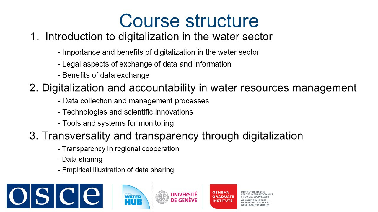
Module 1: Introduction to digitalization in the water sector
Theory 1: Introduction to the course
Theory 2: Legal aspects of exchange of data and information
Theory 3: Benefits of data exchange
Case study: Strengthening data and information sharing in the Lake Titicaca basin
This first module will introduce the political dimension of transboundary waters. During the theoretical input, we will cover the different regimes and institutional architectures for transboundary water governance and explain the actors, scales, and discourses involved. During the practical input, we will examine the case of the lake Titicaca.
This first module will introduce the transformative role of digitalization in water management, with a focus on transboundary cooperation. During the theoretical input, we will explore key concepts and legal frameworks that enable effective data exchange. We will also examine why digitalization is critical not for water governance but also for climate resilience, economic development, and dispute prevention. In the practical input, we will apply these concepts to a real-world case in the Lake Titicaca Basin. By analyzing this example, participants will see how digital tools and inclusion of indigenous knowledge can enhance transparency and trust between riparian countries.
-
-
-
Students mustMark as done
Module 1 overview
Theory 1: Introduction to the course
Theory 2: Legal aspects of exchange of data and information
Theory 3: Benefits of data exchange
-
Types of relevant data and information
-
Modalities and conditions for effective exchanges
Case study: Strengthening data and information sharing in the Lake Titicaca basin
The first module will introduce the political dimension of transboundary waters. During the theoretical input, we will cover the different regimes and institutional architectures for transboundary water governance and explain the actors, scales, and discourses involved. During the practical input, we will examine the case of the lake Titicaca.
This module will introduce the transformative role of digitalization in water management, with a focus on transboundary cooperation. During the theoretical input, we will explore key concepts and legal frameworks that enable effective data exchange. We will also examine why digitalization is critical not for water governance but also for climate resilience, economic development, and dispute prevention. In the practical input, we will apply these concepts to a real-world case in the Lake Titicaca Basin. By analyzing this example, participants will see how digital tools and inclusion of indigenous knowledge can enhance transparency and trust between riparian countries.
-
-
-
-
Students mustMark as done
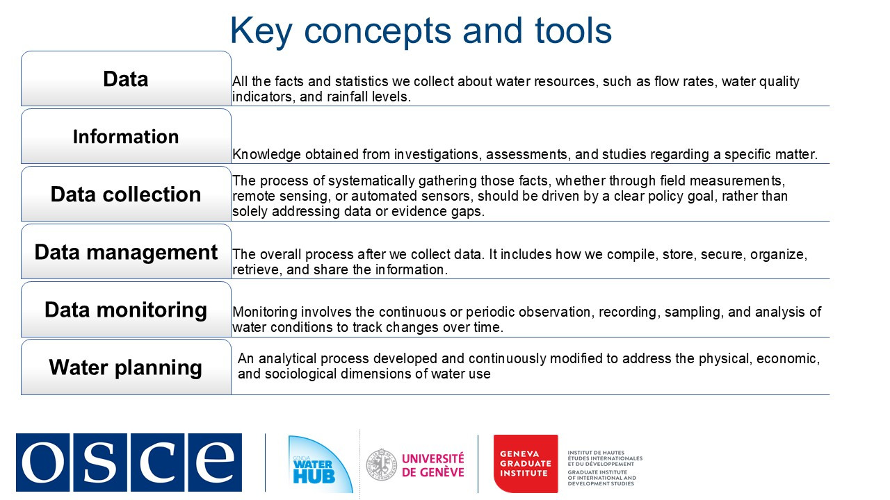
1. Presentation of key concepts and definitions
Welcome to this session on digital transformation in water governance!
In our interconnected world, technology is reshaping how rivers, lakes, and aquifers are shared. Today, we’ll explore core digital concepts that enable effective cross-border cooperation, turning raw data into tools for sustainability and conflict prevention.
One of the key concepts in water governance is data, the foundation of all water decisions. In transboundary contexts, data means measurable facts, such as river flow rates, pollution levels, rainfall patterns collected through field sensors, satellites, or citizen reports. Digital tools now allow real-time gathering, but consistency is critical. For example, when neighboring countries calibrate sensors to the same standards, their shared datasets become actionable.
This leads to data management, the backbone of trust. Imagine a secure regional platform where countries store, update, and access hydrological information. Proper management prevents duplication (like redundant gauging stations) and ensures transparency. The end goal is to transform data into information: analyzed trends that reveal pollution sources or drought risks, often visualized through dashboards accessible to all stakeholders.
Continuous monitoring closes the loop. Automated alerts about sudden pollution spikes or floods enable rapid joint responses, averting crises. For instance, real-time nitrate readings in a shared river can prompt upstream farmers and downstream cities to collaborate on solutions.
These digital tools feed into broader governance. Good water management uses daily data to optimize reservoirs or reduce leaks, while water planning relies on long-term datasets to design climate-resilient policies and good water governance. Both depend on shared data to align local and national priorities with regional needs.
In this session we see how digitalization turns isolated measurements into collaborative solutions, be it tracking pollutants or planning dams. Yet technology alone is not enough. Success hinges on standardized methods, interoperable systems, and crucially, the willingness to cooperate.
-
Students mustMark as done
2. Importance of digitalization in the water sector and other sectors
60% of global transboundary basins still operate without joint agreements. Climate change intensifies regional water scarcity and pollution, and the occurrence of extreme weather events while outdated monitoring systems and lack of equitable cooperation frameworks hinder fair and effective water governance.
Digital transformation offers solutions to such a complex set of challenges. Platforms like the Sava River Basin Commission's Geographic Information System (GIS) system demonstrate how real-time data sharing can replace suspicion and mistrust with cooperation.
The Sava River Basin Commission (ISRBC) was established under the 2002 Framework Agreement on the Sava River Basin. It brings together Bosnia and Herzegovina, Croatia, Serbia, and Slovenia in a shared mission to ensure sustainable development, navigation safety, and flood control along the Sava River.
From its inception, the ISRBC has played a pivotal role in facilitating transboundary water cooperation. One of its core responsibilities is overseeing the exchange of hydrological, navigational, and legislative data among its member states, ensuring that decisions are based on accurate and up-to-date information. To streamline this process, the commission developed the Sava Geographic Information System (Sava GIS), a digital platform that integrates data on river conditions, flood risks, and environmental factors.
Over the years, the ISRBC has achieved significant milestones. With support from the European Union, the World Bank, and other partners, the commission enhanced its flood forecasting capabilities, bringing them in line with EU Floods Directive requirements. Beyond technical advancements, the ISRBC also prioritized the protection of cultural and historical heritage threatened by flooding, integrating these concerns into its risk management strategies.
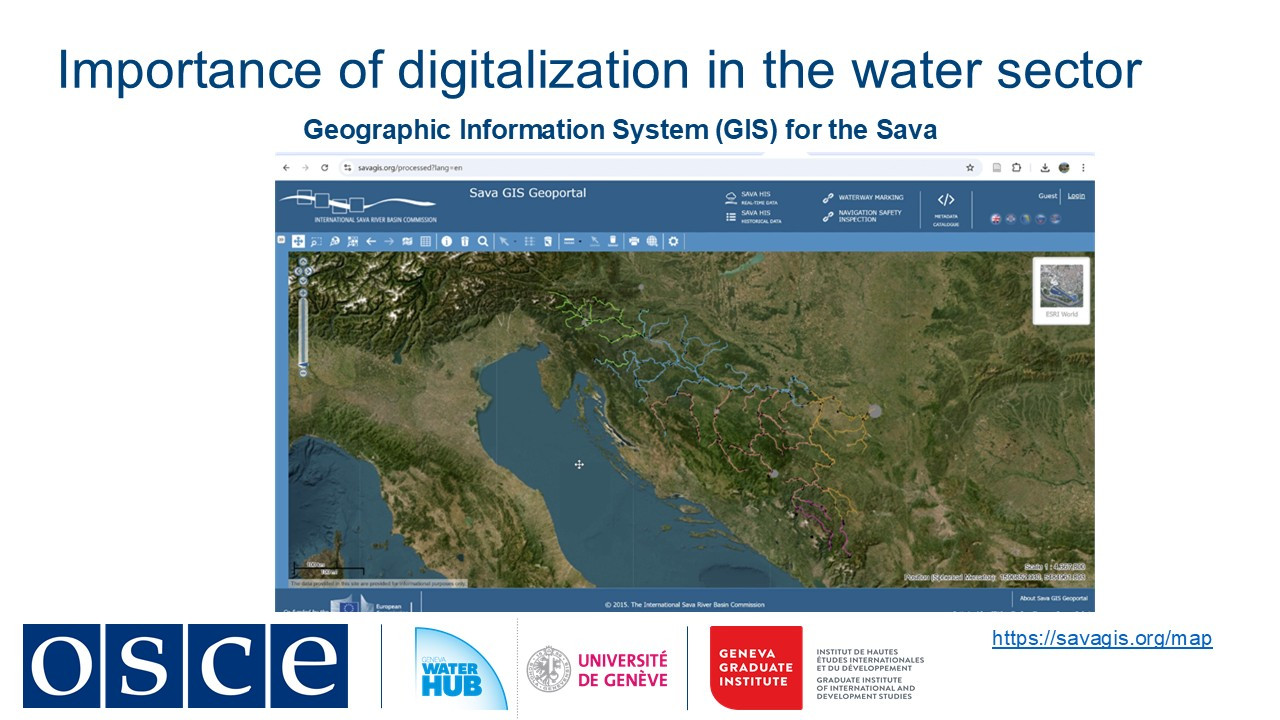
By combining policy coordination with digital tools, the ISRBC has not only improved water governance but also set an example for transboundary river management worldwide.
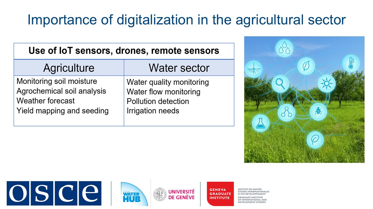
Other sectors offer valuable blueprints:
-
Agriculture: IoT soil sensors in Ukraine and Hungary could be adapted for basin-wide water monitoring
-
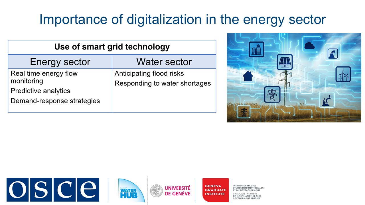
Energy: Estonia's smart grid analytics optimize water distribution like electricity flows
Digital early warning systems turn climate data into action by predicting glacier melt impacts or triggering SMS flood alerts. These tools make adaptation proactive rather than reactive.
Success requires pairing technology with diplomacy. By starting small, for instance, with a data-sharing memorandum or pilot warning system, countries can demonstrate cooperation's value. The OSCE's experience shows that when digital tools are embedded in trust-building frameworks, water becomes a bridge rather than a barrier between states.
-
-
Students mustMark as done
3. Importance of data and information exchange
Effective water management in shared river basins depends on one fundamental element: trust through data sharing. As highlighted by SDG indicator 6.5.2, routine data exchange is a prerequisite for meaningful cooperation rather than a technical formality (UNECE, 2024). When countries share hydrological, meteorological, and ecological information, they lay the groundwork for informed decision-making, emergency preparedness, and long-term resilience.
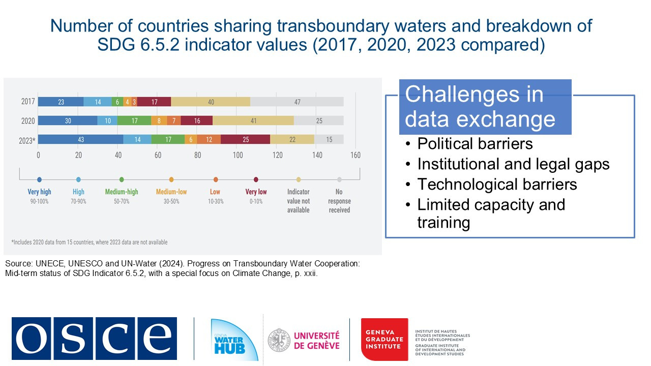
Yet significant challenges stand in the way. According to the 2023 SDG 6.5.2 assessment, three key obstacles persist: inadequate data, limited resources, and inconsistent information-sharing mechanisms. Without unified protocols, even the most advanced monitoring systems fall short.
Political hurdles further complicate cooperation. Upstream developments like dam construction and operation or excessive water withdrawals can trigger tensions with downstream neighbors, particularly where legal frameworks are weak or inexistent, as is the case in 60% of the world’s transboundary basins. Territorial disputes, historic grievances and competing interests often stall negotiations, proving that technical solutions alone cannot succeed without political commitment.
Technological barriers add another layer of complexity. Disparate monitoring systems, outdated infrastructure, and incompatible data standards hinder effective collaboration. In regions like Central Asia and Eastern Europe, gaps in real-time monitoring limit flood and drought response capabilities. Even when new technologies are introduced, capacity gaps often prevent their full utilization.
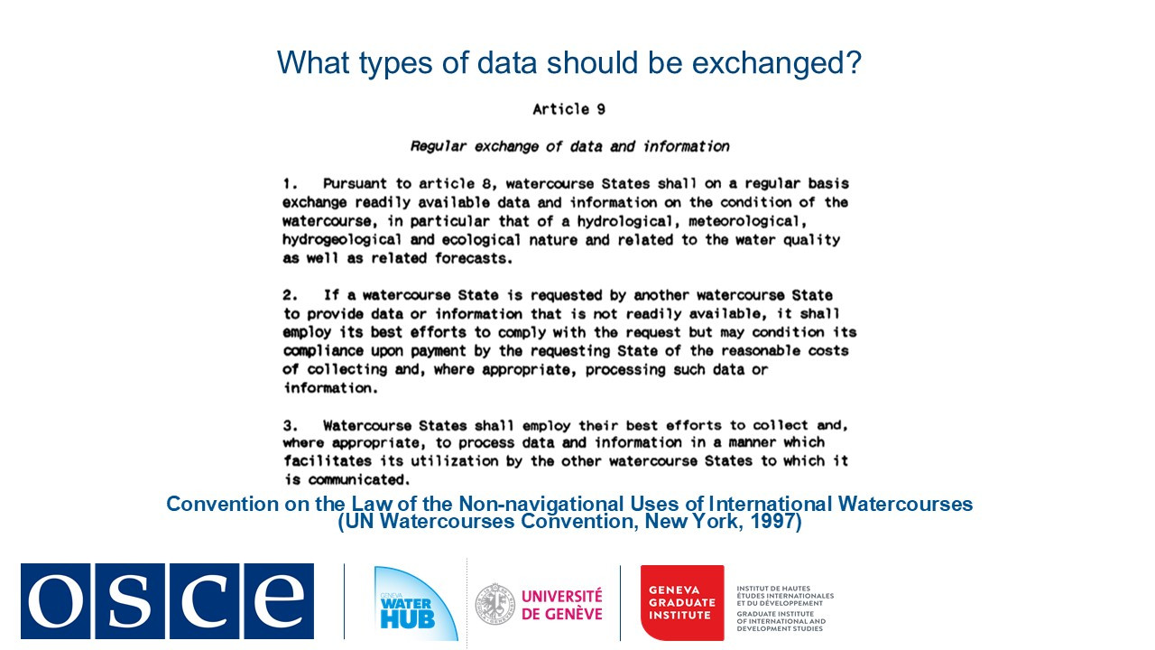
The UN Watercourses Convention provides guidance, emphasizing that "readily available data" should include hydrological, meteorological, and water quality information, shared at agreed intervals, whether monthly, annually, or in real time. This data must be accessible, standardized, and actionable. Socioeconomic indicators should also be included to ensure policies benefit local communities.
Successful examples, such as the Dniester River Basin (where Moldova and Ukraine exchange real-time data), demonstrate how digital systems can foster treaty development and flood coordination. Similarly, the Sava River Basin Commission has shown that GIS-based platforms can integrate diverse datasets, from flood risks to cultural heritage protection, into a unified decision-making framework.
It is clear that equitable transboundary water governance relies on transparency. By establishing straightforward data-sharing protocols, adopting interoperable technologies, and building trust, shared waters can become a source of stability. When countries prioritize accessible, standardized, and timely information, they transform rivers, lakes, and aquifers into drivers for regional cooperation and peace. By learning from successful models and committing to structured, needs-based data exchange, we can ensure that transboundary waters serve as instruments of collaboration for generations to come.
-
Students mustMark as done
4. Emerging trends in digitalization
As we stand at the crossroads of climate change and growing water scarcity, a quiet revolution is transforming how we manage this resource. In this session we track how digital technologies evolved from simple mapping tools to intelligent systems that predict floods and contribute for sustainable use of water.
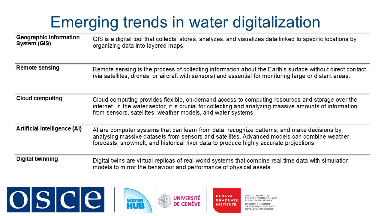
The last five years have seen great leaps in water technology. Artificial Intelligence now crunches massive datasets, such weather models, satellite feeds, and sensor networks, to forecast reservoir inflows with startling accuracy. Digital twins create virtual replicas of entire river basins where managers can simulate floods or test policy changes before implementing them in the physical world. In cities like Burgas, Bulgaria, AI-powered systems detect leaks in water networks almost instantly, saving millions of liters previously lost to aging infrastructure.
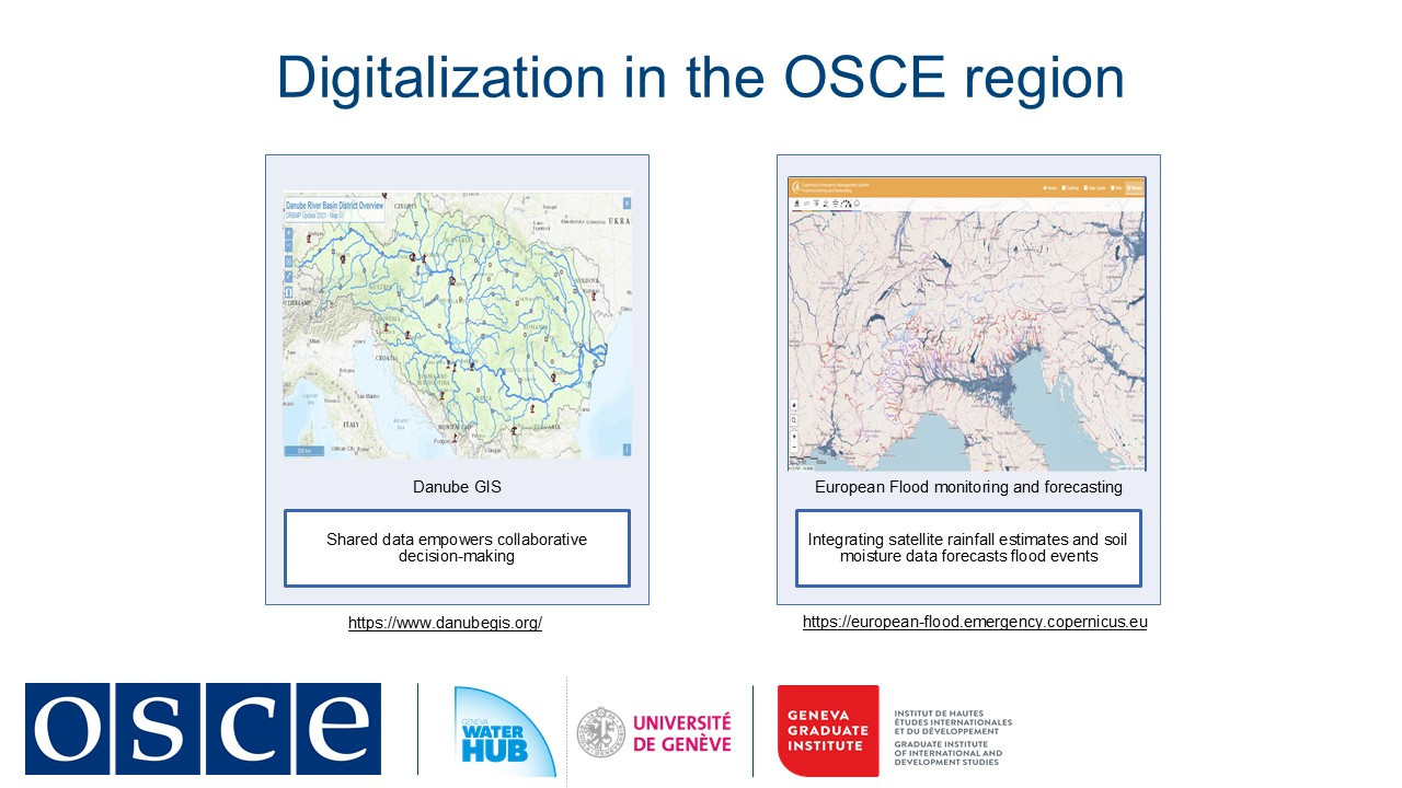
Perhaps most remarkably, these technologies are bridging political divides. Along the Danube River, the DanubeGIS platform allows 19 countries to share hydrological data transparently. In the Dniester Basin, Moldova and Ukraine collaborate through a joint geoportal that tracks water quality and flow regimes in real time.
Yet challenges remain. Many regions struggle with outdated monitoring equipment or lack technical capacity to harness these innovations. In addition, cybersecurity threats are present in increasingly connected water systems. And while satellites provide global coverage, ground data remains essential for calibration and validation.
The road ahead is both promising and demanding. As sensor costs plummet and AI grows more sophisticated, we are moving toward a future where every critical water point can be monitored in real time. But technology alone is not enough as we need stronger institutions, better training, and more inclusive governance to ensure these tools benefit all water users.
This digital transformation represents more than just technical progress. It's a new paradigm for water management: one where data becomes a common language between nations, where predictive systems help us adapt to climate change.
-
-
-
-
-
Students mustMark as done
Legal aspects of exchange of data and information
Now, we focus on how regular information exchange, notification of planned projects, and emergency alerts contribute to preventing disputes and ensuring sustainable water management across borders.
One of the most emblematic examples of cooperation among riparian countries is the practice of exchanging data and information regarding the quality and quantity of transboundary waters. Unfortunately, in some cases, riparian countries do not share this data regularly. In certain circumstances, states may lack the technical and scientific knowledge about a source of water, such as a transboundary aquifer. Moreover, when it comes to major projects such as dams or industrial facilities, some countries may be reluctant to notify neighboring states about developments that could have transboundary impacts.
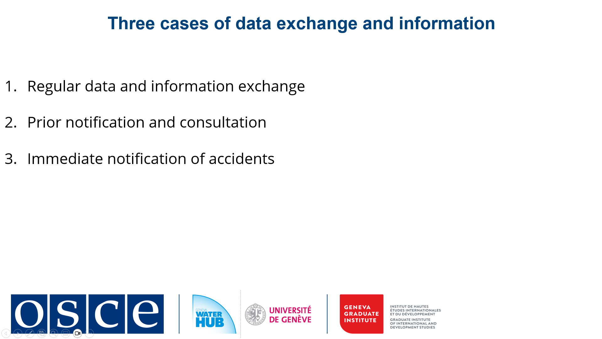
In this course, we offer three distinct cases of data and information exchange:
1) the regular data and information exchange among riparians;
2) the obligations of notification and consultation in the case of planned projects, which include the communication of the results of an environmental impact assessment; and
3) the immediate notification of incidents in transboundary waters that pose a risk of transboundary effects.
In all three cases, information sharing depends on the fundamental duty of cooperation among riparian states, which helps prevent disputes. The exchange of information, notification and consultation allow for early identification of potential sources of disagreement and provide means to prevent their escalation.
-
-
-
-
-
Students mustMark as done
1. Benefits of data exchange. Types of relevant data and information
Human activities and natural events, such as climate change, floods, and droughts, pose serious and growing risks to freshwater resources and the livelihoods that depend on them. These pressures are especially complex in transboundary river basins, where water systems cross national borders and require coordinated action.
Developing and maintaining effective monitoring systems and frameworks for data sharing in these basins demands effort, but the benefits are far-reaching. Reliable data helps us assess the overall condition of river basins, identify emerging issues, track environmental and human-induced changes, estimate pollution levels, and improve disaster preparedness through stronger early warning systems.
Beyond technical benefits, data sharing also plays a key role in building trust and transparency, fostering cooperation, and supporting evidence-based decision-making for sustainable and equitable water management.
Types of relevant data and information
Successful water governance depends on accurate, timely, relevant, and reliable data. But what data are most relevant to share across borders?
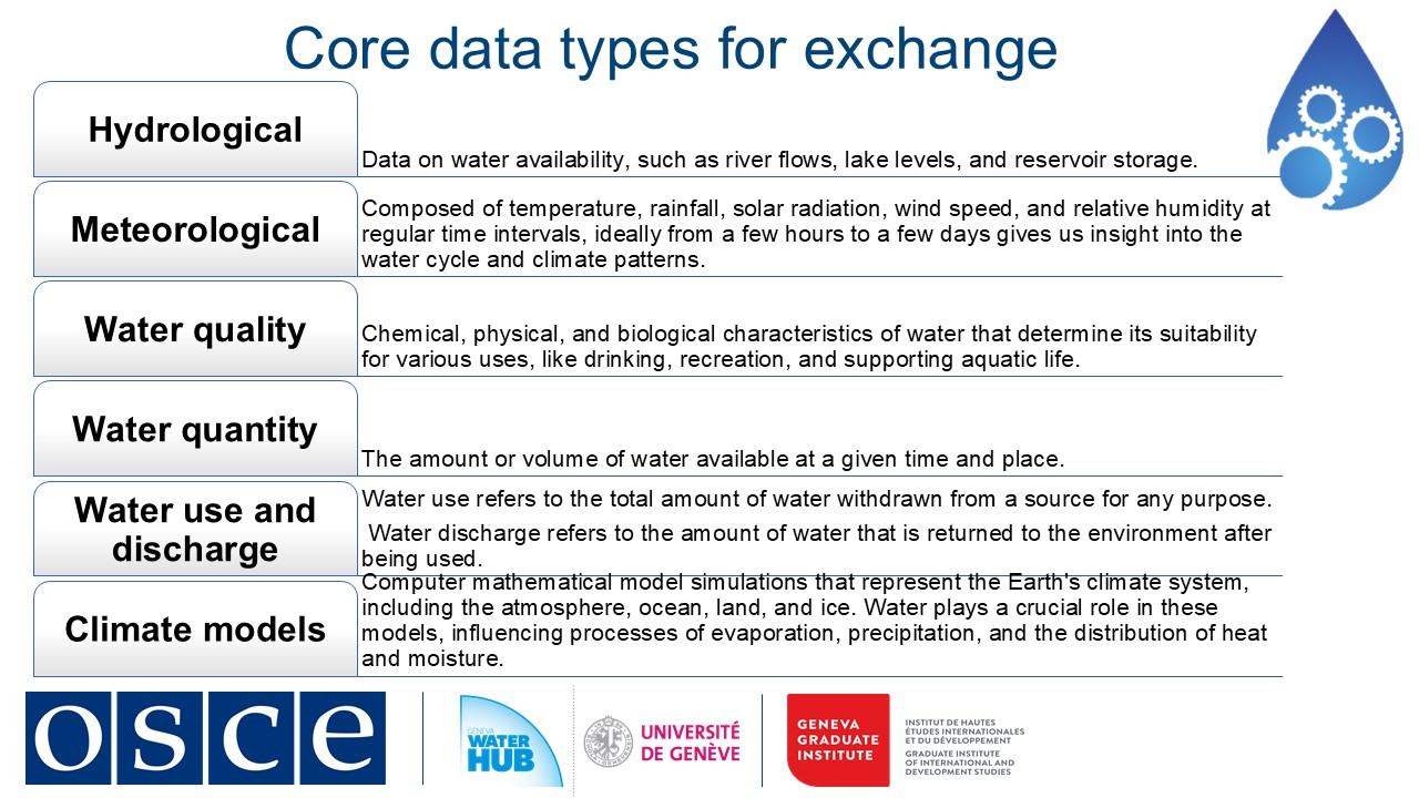
When setting up a monitoring system, it's important to take a practical approach, focusing on the most relevant indicators and challenges specific to the basin. Timing and location of data collection should be aligned with the basin’s most pressing water issues. Some essential areas for data collection and exchange include:
-
Hydrological data: river flows, lake levels, and reservoir storage provide insight into water availability.
-
Meteorological data: rainfall, temperature, humidity, and wind patterns help us understand climatic influences on the water cycle.
-
Water quantity and quality data: supports prediction, risk management, and pollution control.
-
Water use and discharge: how much water is abstracted and returned, which is critical for sustainability and fairness.
-
Climate modeling: helps anticipate extreme weather events such as droughts or floods and prepare proactively.
Regular exchange of this information enables more sustainable, inclusive, and climate-resilient water management practices.
Environmental data, particularly on ecological health, is equally important. Pollution remains a widespread threat, often originating from municipal, industrial, and agricultural sources. These contaminants affect both human health and ecosystem resilience. Monitoring and sharing data on pollutant types and sources helps ensure accountability and supports timely interventions across borders.
Another vital, yet often neglected component of the water cycle is groundwater, which accounts for approximately 30% of the world’s freshwater. It serves as a crucial source of drinking water, agricultural irrigation, and industrial use, and acts as a natural buffer during droughts.
Effective basin-level management requires a comprehensive view of the entire water cycle, including both surface and groundwater, upstream and downstream systems. This holistic approach ensures that no element is overlooked in planning and policy.
-
-
Students mustMark as done
2. Modalities and conditions for effective exchanges
Effective transboundary water management relies on robust data exchange, which can take various forms. Data sharing may be direct, with treaties specifying exact parameters like river flow rates and water quality levels, or indirect, occurring through notifications and structured discussions. Countries might also share water data through indirect mechanisms, such as prior notification of planned measures and formal communications via joint institutions or political consultations. While informal collaboration among experts and researchers can supplement these efforts, formal agreements provide greater reliability and consistency in data exchange.
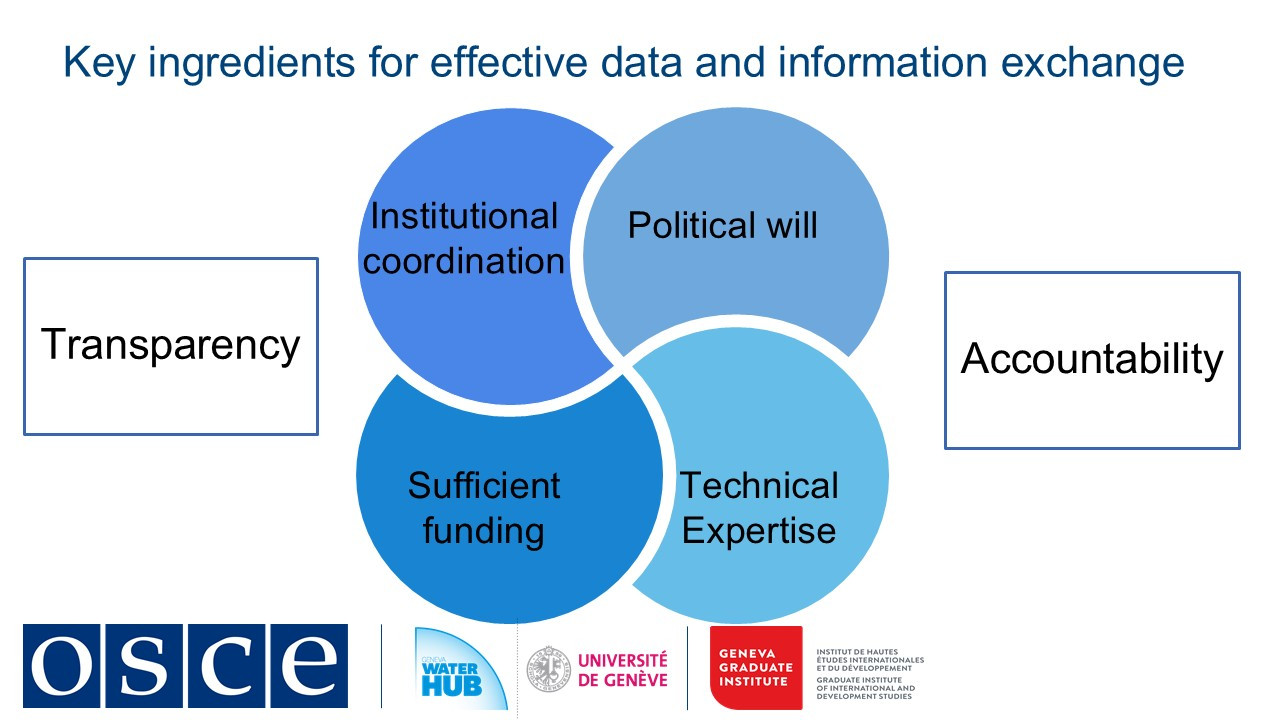
A strong political commitment from decision-makers forms the foundation of effective data exchange. Countries with shared values and interests are more likely to build trust, engage in negotiations, and establish long-term cooperation frameworks. Without political will, even well-crafted agreements risk remaining unimplemented. To operationalize these commitments, intergovernmental agreements must establish clear mandates for riparian states to share data, empowering national institutions and joint bodies to collect, process, and disseminate information systematically.
Institutional coordination is equally important. Water management involves multiple agencies at national and local levels, each contributing to data collection and exchange. Effective coordination prevents duplication of efforts and ensures seamless intrastate and interstate decision-making.
Technical expertise is another essential component. Accurate data collection, analysis, and interpretation require specialized knowledge in satellite technology, telemetry, and communication networks. Skilled professionals are necessary to maintain data reliability, which underpins sound water management decisions.
However, expertise alone is insufficient without sustainable funding. Governments must allocate resources for measurement tools, personnel, software, and infrastructure maintenance. Inconsistent funding can undermine data quality, reducing its usefulness for policymaking.
Transparency is vital to ensure that data-sharing efforts align with their intended goals. Open and verifiable processes build trust between countries, fostering effective cooperation. Accountability mechanisms, such as regular reporting and public access to information, allow stakeholders to monitor compliance and assess the effectiveness of water management strategies.
Since water resources directly impact communities, involving local populations in decision-making is crucial. Public participation ensures that water management aligns with the needs of those who depend on these resources for drinking, agriculture, and livelihoods. Engaging communities enhances monitoring efforts and promotes more sustainable solutions
-
Students mustMark as done
3. Case study: Strengthening data and information sharing in the Lake Titicaca basin
In the case study on the lake Titicaca we explore how local communities, particularly indigenous people, are strengthening data and information sharing in transboundary waters. While cooperation between states is often seen as the domain of ministries and high-level officials, we must recognize that effective water governance depends equally on non-state actors, especially those who live closest to these shared resources.
Lake Titicaca, the world’s highest navigable lake (at 3,812 meters above sea level), is a vital transboundary water resource shared by Peru and Bolivia. Spanning approximately 8,372 km², it is the largest freshwater lake in South America and a lifeline for over 3 million people, including indigenous Aymara and Quechua communities who consider it sacred. The Aymara and Quechua rely on the lake for fishing, agriculture, and tourism, embedding it in their spiritual and cultural identity. However, many lakeside communities lack basic services, exacerbating reliance on the lake’s dwindling resources.
Lake Titicaca basin currently faces severe threats:
-
Pollution from mining, agriculture, and urban runoff;
-
Poverty and limited economic opportunities for lakeside communities;
-
Governance gaps, despite the existence of the binational Lake Titicaca Authority.
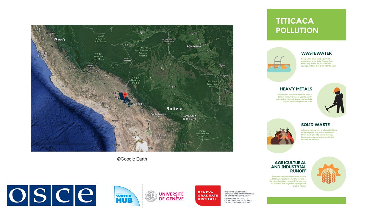
While institutions exist, local communities often feel excluded from decision-making, leaving the lake’s protection unevenly enforced.
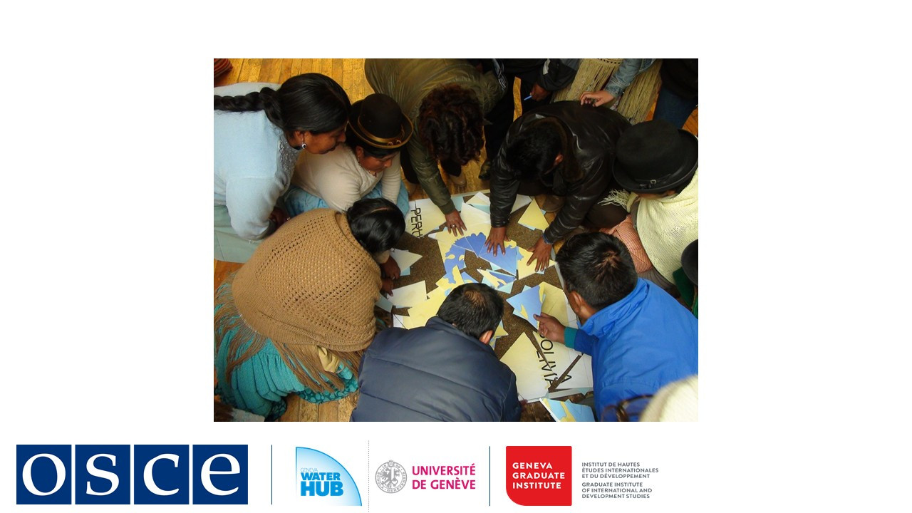
For over a decade, IUCN’s BRIDGE program has worked to foster cooperation in the Titicaca Basin by bridging divides between governments and communities, and between traditional knowledge and modern science.
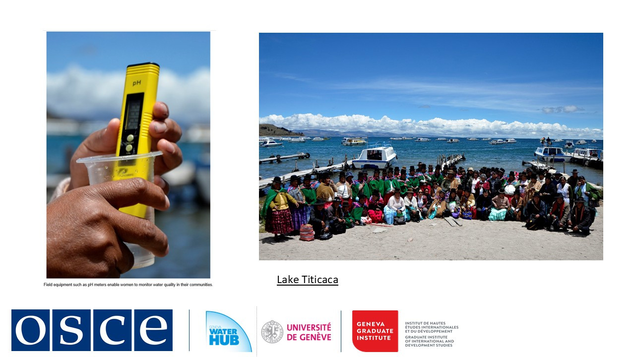
These initiatives highlight a precious lesson: Indigenous communities are not just one of stakeholders but essential partners in data collection and water governance. The work in Lake Titicaca is just one example of how local empowerment transforms water diplomacy. We encourage you to explore BRIDGE’s efforts in this basin and beyond at waterandnature.org.
-
-
-
-
-
-
-
-
Students mustMark as done
1. Data collection and management process
Digital technologies are transforming how we manage water resources, from smart sensors to predictive modeling. But beyond the technical innovations lies a critical question: How can these tools promote transparent, equitable, and accountable water governance?
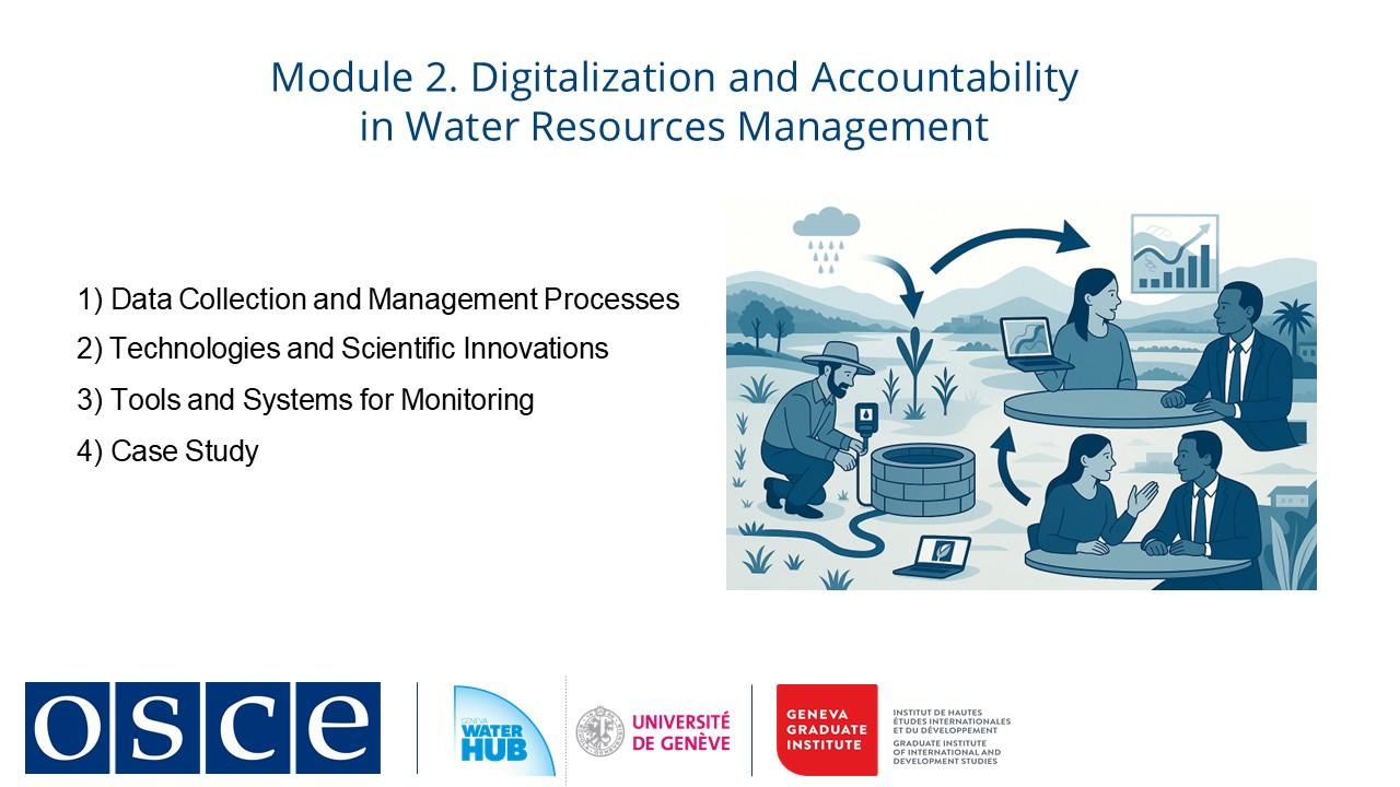
This module examines the opportunities and challenges of digital water management, focusing on the full data cycle, collection, interpretation, analysis, and dissemination. We explore how data systems shape decision-making, who benefits from these technologies, and what governance structures ensure they serve the public interest.
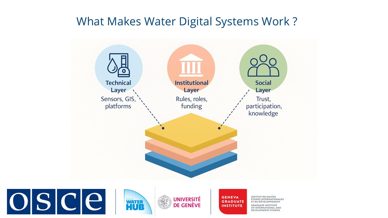
Effective water resource management relies on a continuous data cycle: collection, interpretation, analysis, and dissemination. It depends on structured data systems that integrate technical, institutional, and social dimensions. The process begins with data collection, where information is gathered through sensors, satellite monitoring, and community reporting. However, the scope and accuracy of collected data are influenced by factors such as sensor placement, funding allocations, and institutional priorities, which can lead to gaps in coverage, particularly in informal settlements or rural areas. Data is gathered through sensors, satellites, and community reports, though coverage gaps may persist in underserved areas. Raw data is then processed and classified using scientific standards, which may not always align with local knowledge.
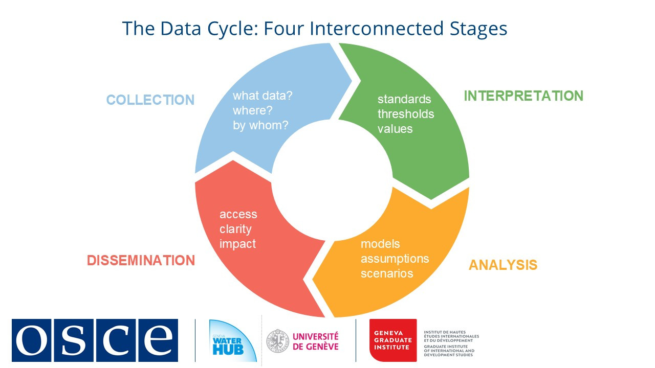
Analysis transforms this data into projections using models like WEAP (Water Evaluation And Planning system) or machine learning, dependent on input assumptions about usage and climate. Finally, dissemination delivers insights to decision-makers and communities, requiring clear communication to bridge technical and practical needs.
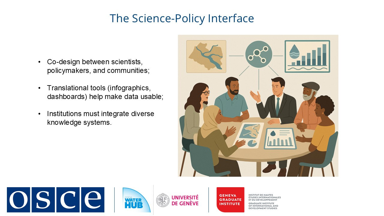
The full data cycle operates within a broader governance framework, where accountability depends not only on technological capacity but also on inclusive design. Digital tools, such as real-time dashboards, can enhance transparency, but their impact is determined by whether institutions prioritize equitable participation, ethical data practices, and adaptive policy responses. Thus, a well-functioning data system is one that aligns technical capabilities with social and institutional structures to support informed, responsive, and inclusive water governance.
-
Students mustMark as done
2. Technologies and scientific innovations
Building on our exploration of digital water governance, we now examine how technology is transforming our approach to one of water management's most critical challenges: ensuring water quality.
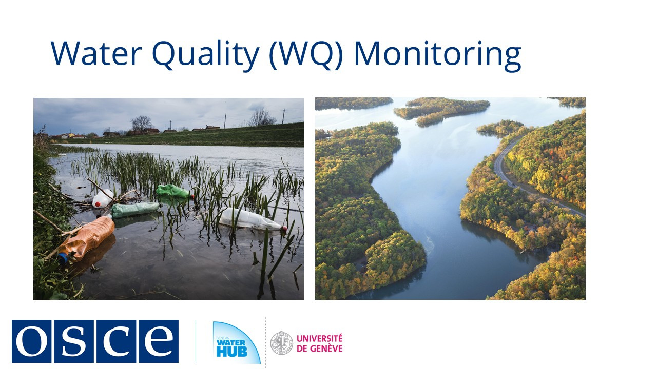
As new contaminants emerge and monitoring capabilities advance, understanding these dynamics becomes essential for protecting human health, ecosystems, and livelihoods.
Water quality issues stem from both natural processes and human activities, affecting everything from drinking water safety to agricultural productivity.
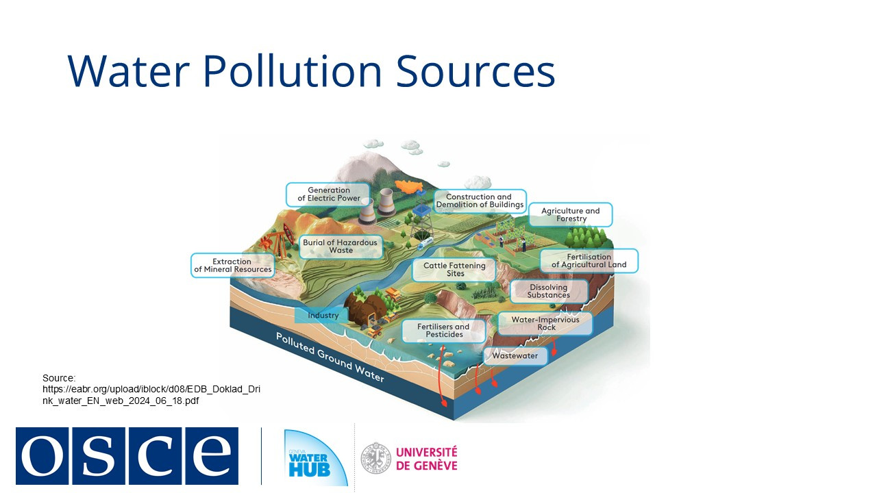
Traditional concerns like nutrient pollution and pathogens remain persistent threats, while emerging contaminants present new risks with still-uncertain impacts. These challenges vary by region and development level, but all underscore the same reality: abundant water means little if it's unsafe for use.
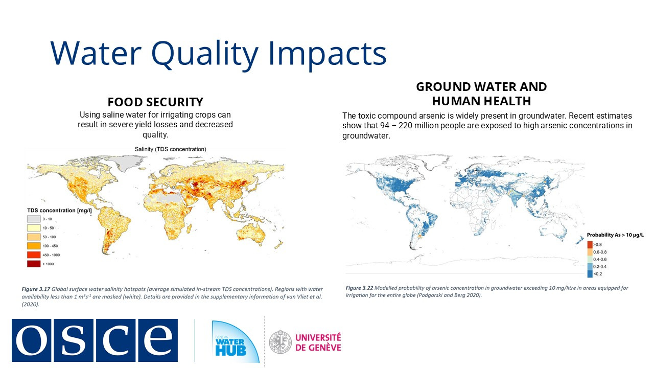
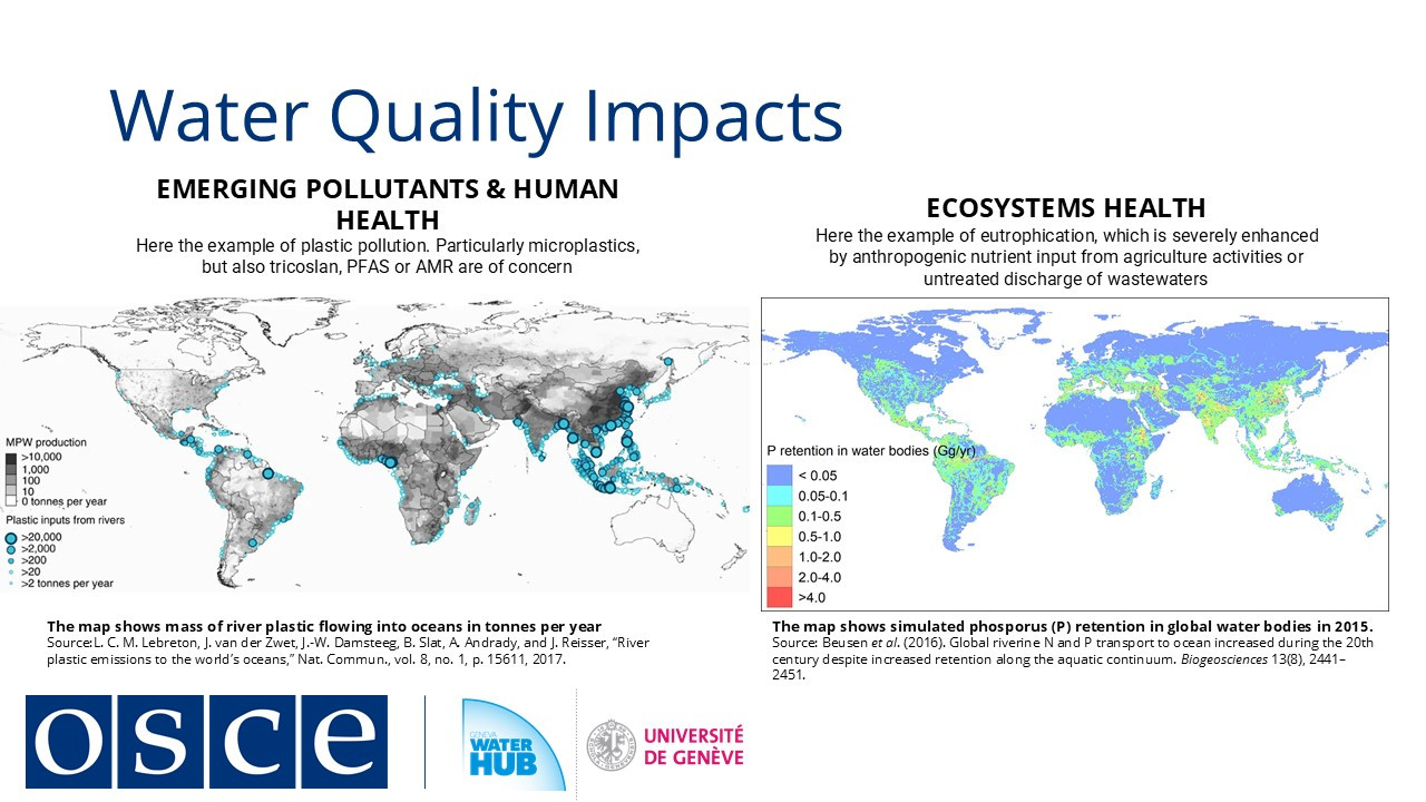
Effective water quality management begins with robust monitoring systems. By tracking physical (e.g., temperature, turbidity), chemical (e.g., nitrates, toxins), and biological (e.g., bacteria, algae) indicators, we can identify risks, enforce standards, and prioritize interventions. However, monitoring efforts often face gaps due to uneven capacities, fragmented institutional mandates, or limited resources, especially in transboundary basins where coordination is critical.
Digital innovations are revolutionizing water quality monitoring. Remote sensors, AI-driven analysis, and low-cost tools are making data collection more accessible and actionable, helping bridge gaps between high- and low-resource settings. Yet technology alone is not a panacea: its effectiveness depends on political will, harmonized standards, and inclusive governance to ensure data translates into equitable solutions.
Building on our exploration of digital water governance, we now examine how technology is transforming our approach to one of water management's most critical challenges: ensuring water quality. As new contaminants emerge and monitoring capabilities advance, understanding these dynamics becomes essential for protecting human health, ecosystems, and livelihoods.
Water quality issues stem from both natural processes and human activities, affecting everything from drinking water safety to agricultural productivity. Traditional concerns like nutrient pollution and pathogens remain persistent threats, while emerging contaminants present new risks with still-uncertain impacts. These challenges vary by region and development level, but all underscore the same reality: abundant water means little if it's unsafe for use.
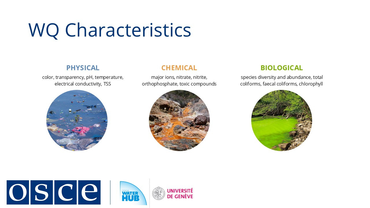
Effective water quality management begins with robust monitoring systems. By tracking physical (e.g., temperature, turbidity), chemical (e.g., nitrates, toxins), and biological (e.g., bacteria, algae) indicators, we can identify risks, enforce standards, and prioritize interventions. However, monitoring efforts often face gaps due to uneven capacities, fragmented institutional mandates, or limited resources, especially in transboundary basins where coordination is critical.
Digital innovations are revolutionizing water quality monitoring. Remote sensors, AI-driven analysis, and low-cost tools are making data collection more accessible and actionable, helping bridge gaps between high- and low-resource settings. Yet technology alone is not a panacea: its effectiveness depends on political will, harmonized standards, and inclusive governance to ensure data translates into equitable solutions.
-
Students mustMark as done
3. Tools and systems for monitoring
Building on our discussion of water quality challenges, we now examine the tools and approaches used to monitor water quality effectively, particularly in transboundary contexts where cooperation is essential.
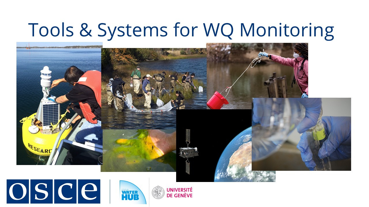
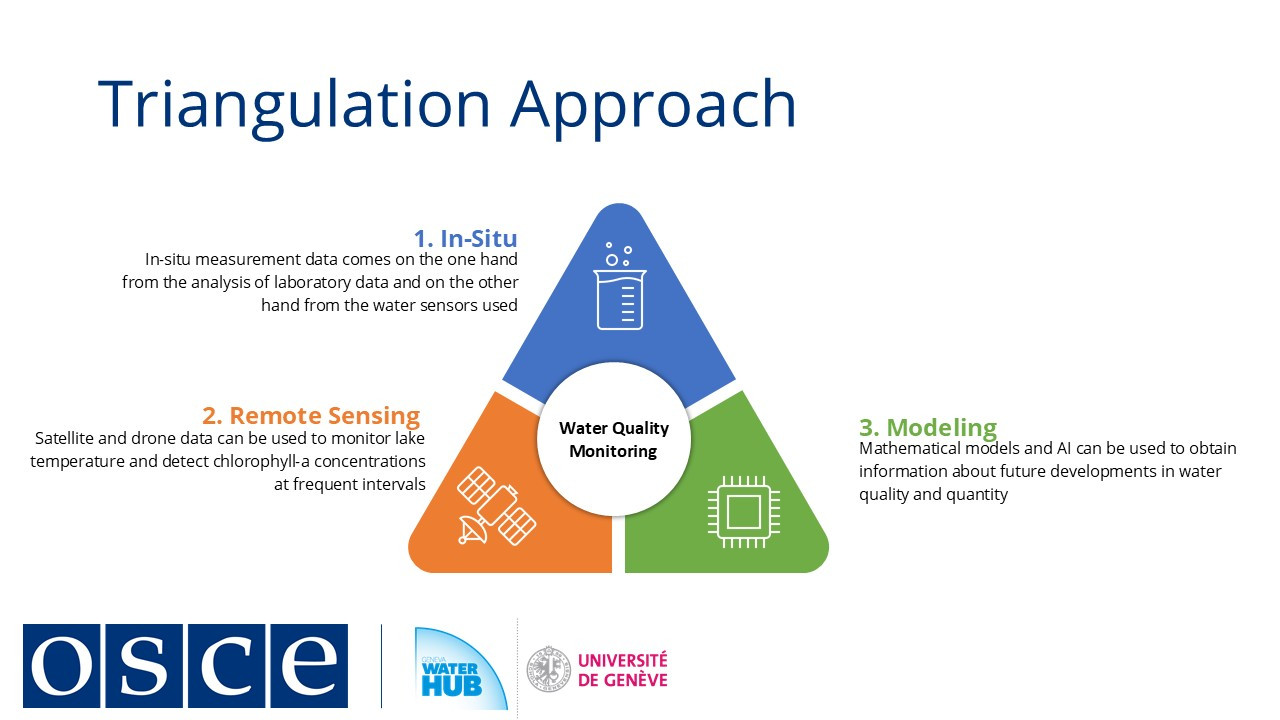
Modern water quality monitoring draws on three complementary methods:-
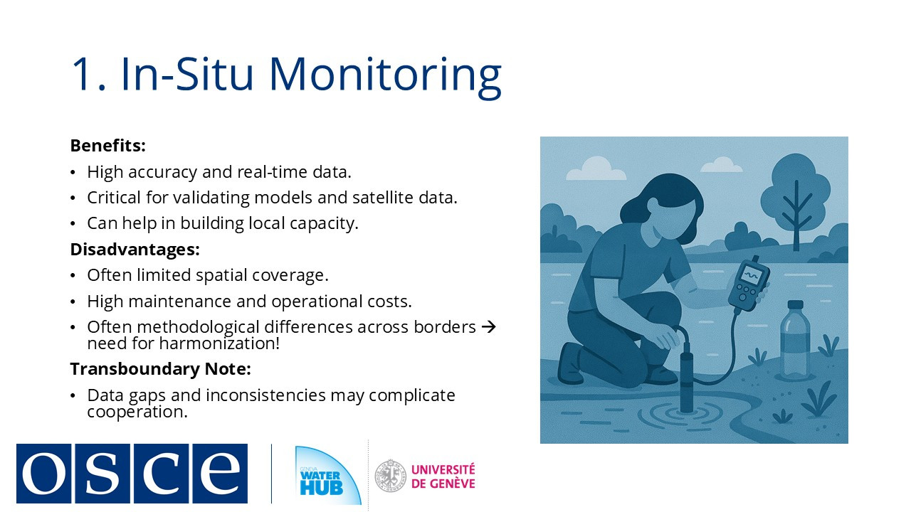
In-situ measurements using IoT sensor networks for real-time data collection, which also serve as trust-building exercises through joint sampling initiatives between neighboring states;
-
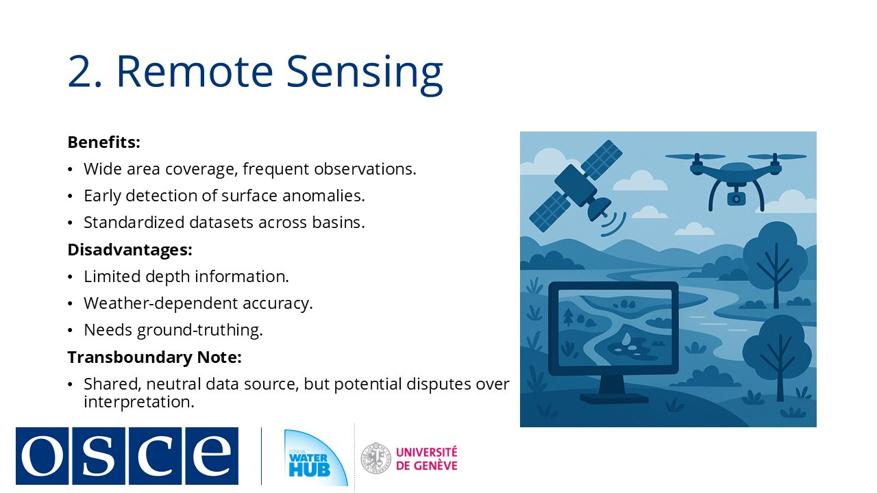
Remote sensing via satellites to track large-scale pollution like algal blooms or illegal water withdrawals;
-
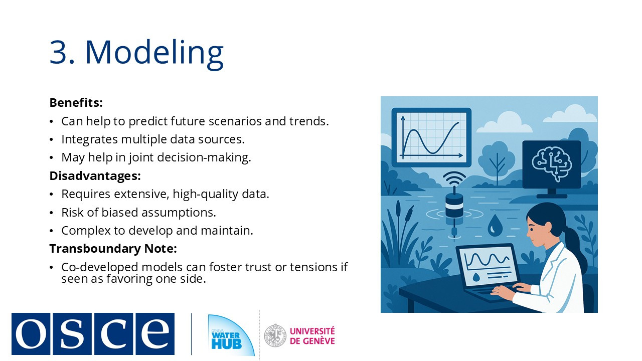
Modeling systems that simulate water quality scenarios to support joint planning.
Effective water quality monitoring relies on integrated approaches combining in-situ measurements, remote sensing, and modeling. Modern sensor networks enable real-time data collection, while satellite technology provides large-scale observation capabilities. Computational models complement these methods by simulating water quality scenarios and filling data gaps.
In transboundary contexts, joint monitoring initiatives serve both technical and diplomatic purposes. Collaborative data collection between neighboring states promotes transparency and builds institutional trust. The Kazakhstan-Uzbekistan working group in the Syrdarya River basin demonstrates how such cooperation can expand to include additional regional partners over time.
Emerging technologies like blockchain and artificial intelligence enhance monitoring systems by improving data security and enabling predictive analysis. However, successful implementation depends on aligning these tools with governance frameworks and ensuring public accessibility of information. When combined with community engagement and open data practices, these systems support evidence-based decision-making while fulfilling international commitments to water quality management.
The effectiveness of monitoring programs ultimately depends on their integration with policy processes and their capacity to address both current pollution challenges and emerging climate-related risks.
-
-
Students mustMark as done
4. Case study of integration of technology with participatory approaches in Sidi Bouzid, Tunisia
This module concludes by examining how digital water governance principles are implemented in real-world contexts. A case study from Sidi Bouzid, Tunisia, demonstrates the integration of technology with participatory approaches to address groundwater management challenges.
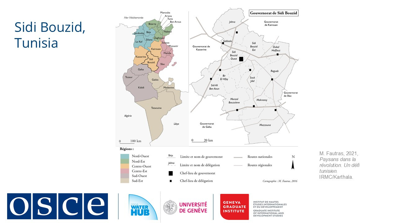
In this agricultural region, groundwater depletion created tensions between farmers and water authorities.
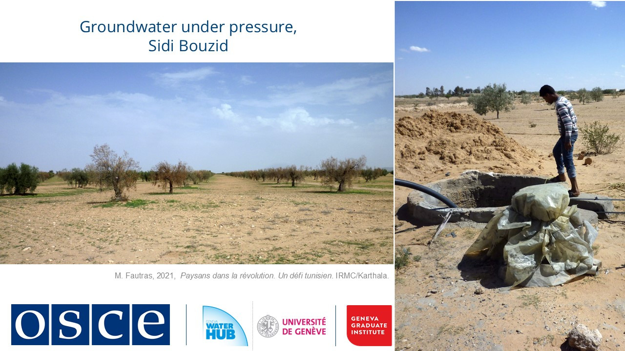
While data existed, the lack of shared understanding hindered effective management.

A local initiative addressed this through a four-part approach:
-
Deployment of low-cost piezometers connected to a mobile app, enabling farmers to monitor well levels in real time;
-
Creation of a shared data platform allowing comparison of groundwater trends across villages;
-
Establishment of "data cafés" where farmers and officials jointly interpreted data;
-
Engagement of water authorities who incorporated community findings into management decisions.
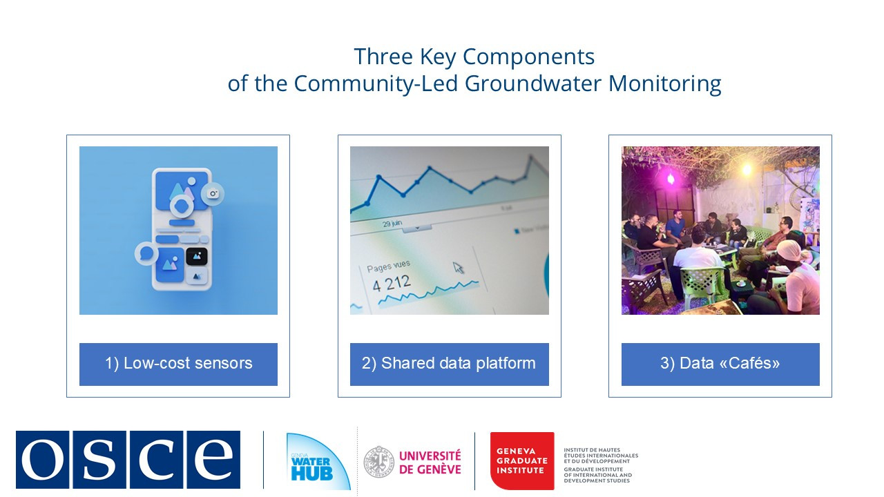
The initiative improved both technical understanding and institutional relationships. Farmers gained evidence-based insights into aquifer dynamics, while authorities adjusted pumping schedules based on community-collected data. This case highlights how digital tools gain value when embedded in social processes, creating transparency and shared ownership of information.
The lessons from this local project have broader relevance, particularly for transboundary contexts where multiple jurisdictions and competing interests complicate water management. As demonstrated, effective digital water governance depends not on technology alone, but on its integration with participatory processes that build trust and collective understanding.
This module has shown that digital transformation in water management requires balancing technical solutions with social and institutional considerations. When successfully implemented, such approaches can turn data into actionable knowledge while fostering cooperation among diverse stakeholders.
-
-
-
-
-
-
-
-
Students mustMark as done
1. The role of transparency in transboundary water management
Transparency in water governance means ensuring that data, processes, and decisions are accessible and understandable to relevant stakeholders. However, the degree of openness varies, as some data is restricted to experts, while other information is publicly available.
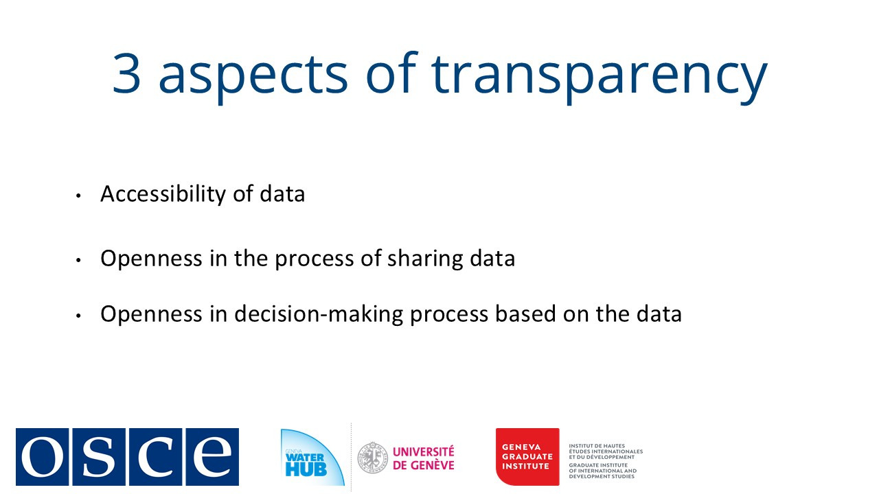
In transboundary water management, transparency operates at three key levels:
-
Data accessibility: Is hydrological, meteorological, or usage data available to stakeholders, or is it restricted?
-
Process openness: Are the methods of data collection, analysis, and modeling shared to allow quality assessment?
-
Inclusive decision-making: Are governance processes open to participation beyond technical and political elites?
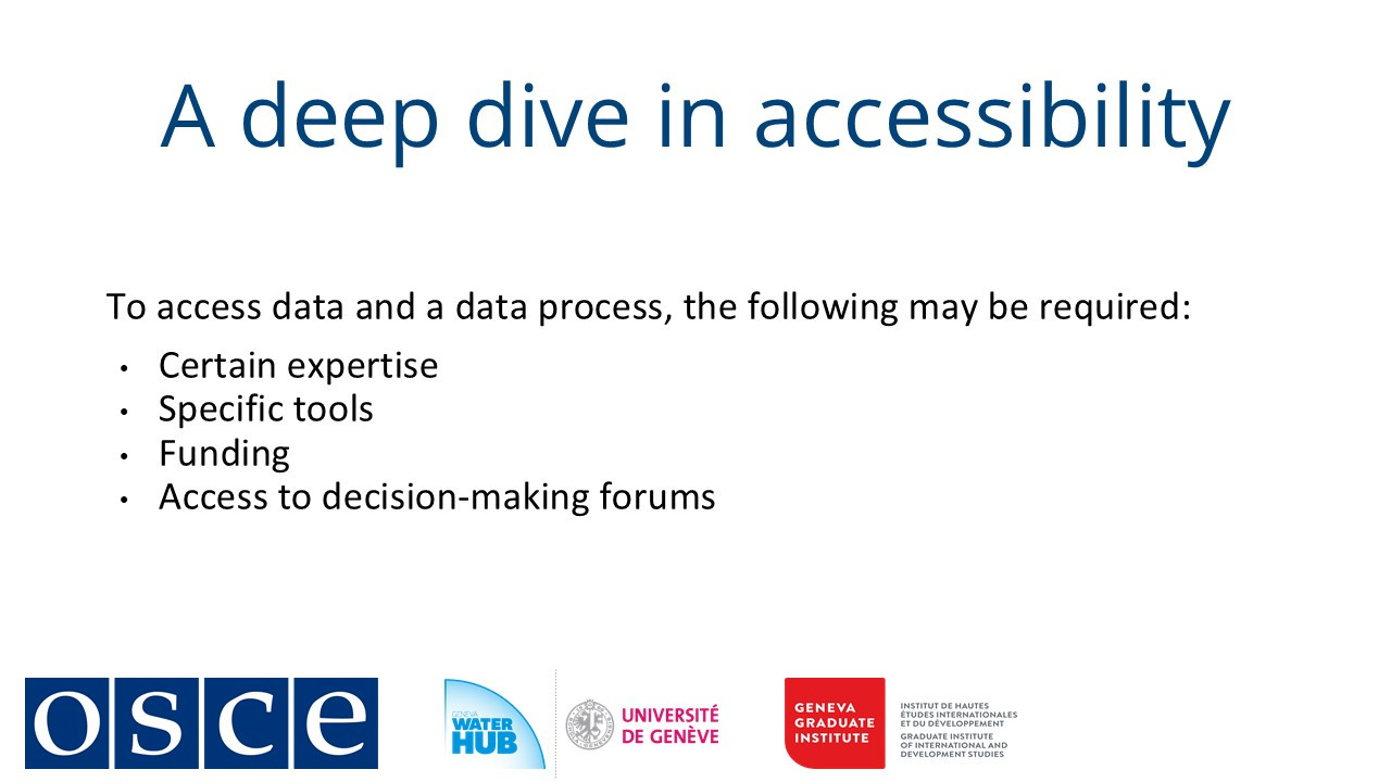
Despite its benefits, transparency faces significant barriers. Many stakeholder groups, particularly local communities, indigenous groups, and marginalized populations are excluded due to technical, financial, or institutional obstacles. For instance, interpreting hydrological data often requires specialized expertise, while participation in decision-making forums may depend on political access or funding.
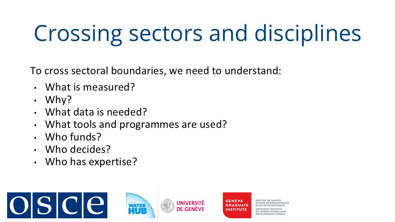
Water management intersects with food and energy systems, yet these sectors frequently operate in isolation. Divergent monitoring standards, incompatible datasets, and competing institutional priorities hinder integrated planning. Effective coordination requires aligning data collection, agreeing on shared platforms, and clarifying decision-making responsibilities, which is often a slow and politically fraught process.
Transparency is a deeply political element. Open data can empower accountability, such as when poor water quality triggers public scrutiny or legal penalties. However, it can also provoke resistance because governments or institutions may withhold data due to fears of exposing non-compliance, inviting external interference, or losing control over information. Additionally, open datasets can be exploited by private entities, raising ethical concerns.
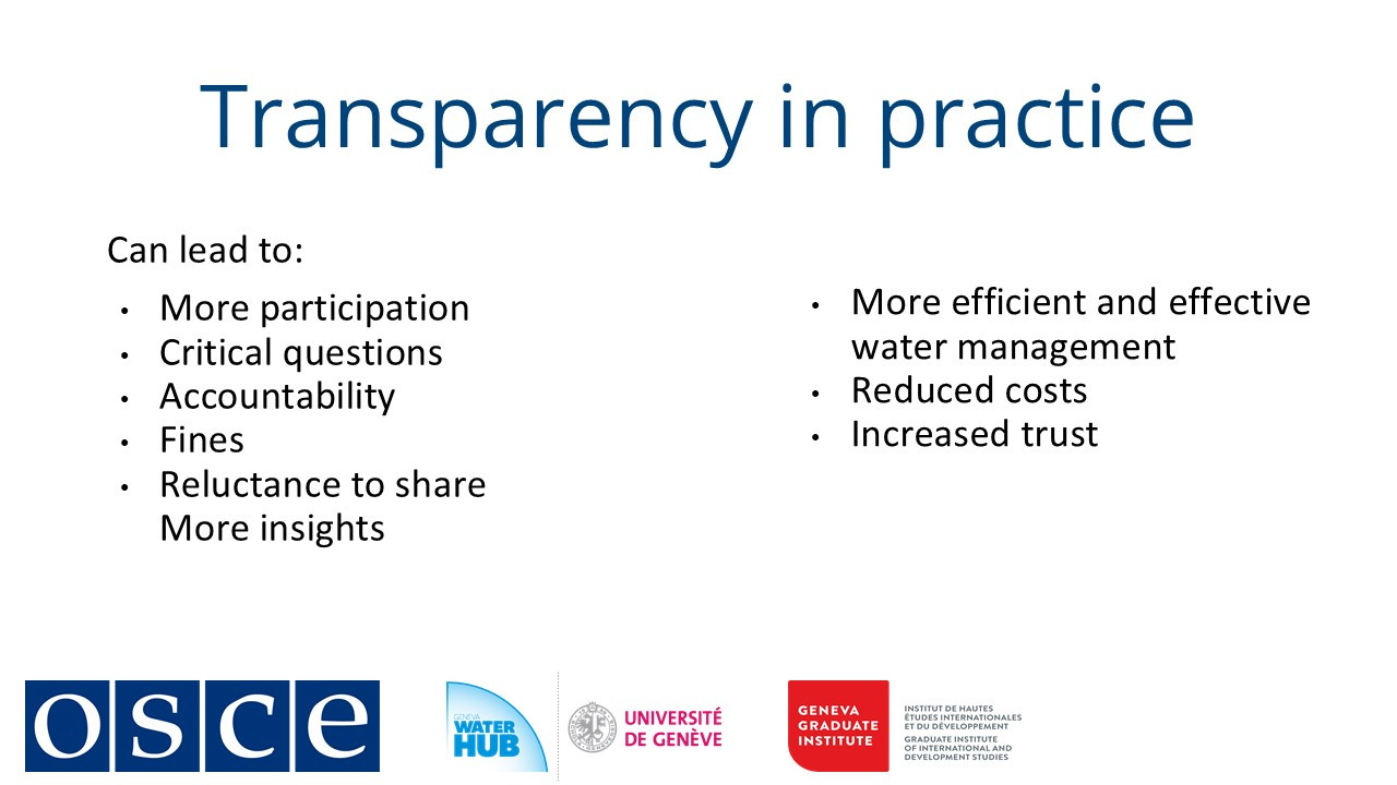
Despite these challenges, transparency strengthens water governance by improving efficiency, reducing costs, and fostering trust between nations. Over time, robust monitoring systems can depoliticize data sharing, as stakeholders grow accustomed to collaborative frameworks. Institutionalized transparency also supports compliance with international agreements, ensuring more sustainable and equitable water management.
-
-
Students mustMark as done
2. Data and neutrality: the political nature of data monitoring
Scientific measurements in water management are often perceived as neutral, yet they are inherently political. Data collection, such as river flow measurements or pollution sampling, depends on where, what, and how variables are measured, influencing interpretations and policy decisions. For example, differing sampling locations along a transboundary river can yield conflicting conclusions about water quality, leading to disputes.
Beyond raw data, assessments require value judgments, such as determining acceptable water quality standards. These benchmarks are not purely scientific but are shaped by policy agreements (e.g., the EU Water Framework Directive) and negotiations between stakeholders. Disagreements over thresholds or pollution sources highlight the political dimensions of water governance.
What is the difference between monitoring and assessment?
-
Monitoring involves long-term data collection on water quantity and quality, supporting regulatory and usage decisions (e.g., drinking water safety);
-
Assessment is often short-term and investigative, identifying pollution sources (e.g., industrial leaks) or causes of groundwater depletion.
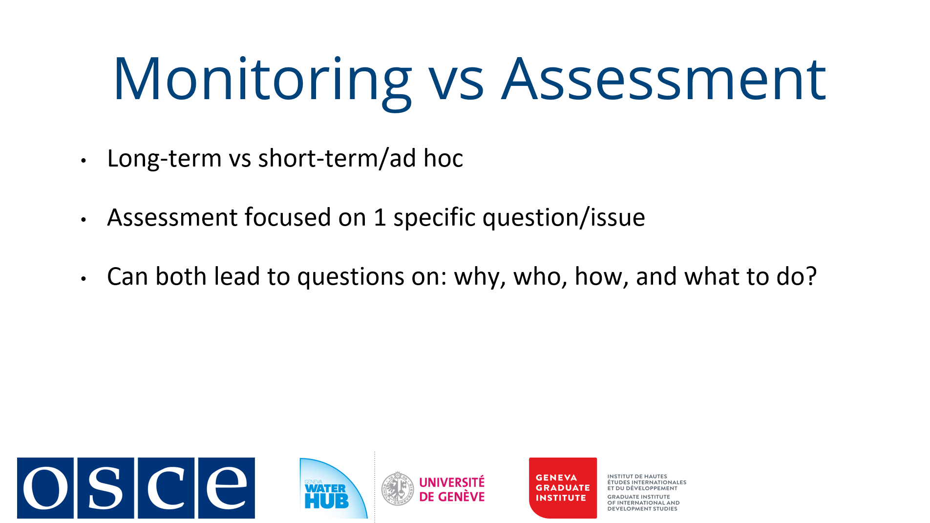
Both processes operate at the science-policy interface, blending technical methods with political negotiation. Divergent methodologies do not necessarily invalidate data but underscore the need for agreed-upon protocols. Joint fact-finding, where stakeholders collaboratively define monitoring goals, methods, and funding, can mitigate conflicts by ensuring mutual acceptance of findings.
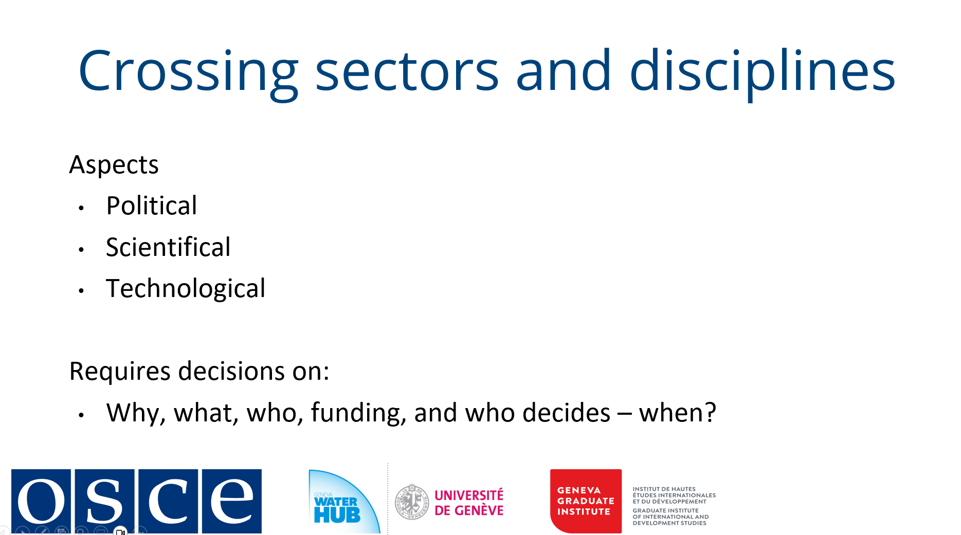
Ultimately, water data is never purely neutral; it reflects the priorities, power dynamics, and institutional frameworks of those who collect and use it. Transparent, cooperative approaches are essential to balancing scientific rigor with equitable decision-making.
-
-
-
-
-
-
Students mustMark as done
1. Examples of open data platforms and the importance of data standards
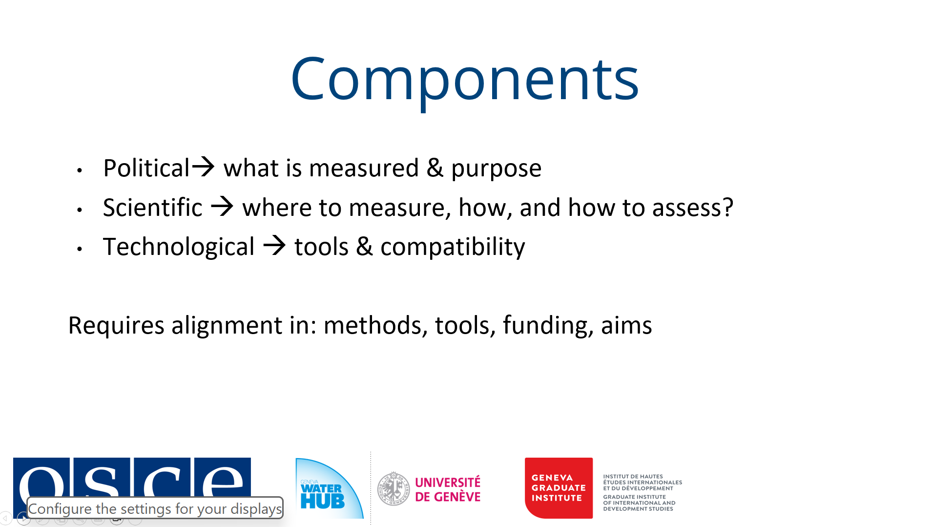
Effective water management relies on robust data collection and sharing systems that operate at the intersection of science, policy and technology. While technological advances like remote sensing and cloud computing have dramatically expanded our monitoring capabilities, the true potential of these tools can only be realized through establishing comprehensive data standards that address political, scientific and technical dimensions.
From a political perspective, data standards fundamentally shape what gets measured and why, reflecting policy priorities and governance structures. The selection of monitoring parameters and indicators often involves delicate negotiations between stakeholders with competing interests. Scientifically, standards ensure methodological consistency in data collection approaches, whether using remote sensing platforms or ground-based measurements, and analytical techniques. The choice between different evapotranspiration models or water quality assessment methods, for instance, can significantly influence the resulting datasets and their interpretation.
On the technical side, interoperability remains a critical challenge. Even when measuring the same phenomena, differences in data formats, storage systems and analytical tools can create barriers to effective data sharing and integration. A monitoring system using one software platform may produce datasets incompatible with another country's analysis tools, despite measuring identical water parameters. These technical hurdles often mirror deeper political and institutional divides in transboundary water management.
The implementation of open data platforms represents a promising approach to overcoming these challenges while enhancing transparency. These systems range from restricted-access platforms for authorized government agencies to fully public portals, with access levels reflecting both technical capacities and political agreements. Successful examples include real-time water quality monitoring networks in shared river basins and global frameworks like the UN's Sustainable Development Goal monitoring system, where countries contribute standardized water indicators.
However, the effectiveness of such platforms depends on more than just technical design. Truly functional data sharing systems require alignment across multiple dimensions: consistent monitoring protocols, compatible measurement technologies, harmonized analytical methods, and perhaps most critically, sustained political commitment. When these elements converge, the benefits are substantial - reduced monitoring costs, minimized conflicts over data interpretation, and more efficient water governance.
-
Students mustMark as done
2. Challenges and ways forward
The evolving landscape of data sharing and water management faces both geopolitical and technological challenges. Geopolitical tensions increasingly influence countries' willingness to share data transparently, with concerns over data sovereignty and accountability shaping international cooperation. Despite these constraints, the benefits of open data supporting decision-making, public accountability, and efficient water governance remain critical, particularly for local communities dependent on shared water resources.
Technological advancements offer promising solutions but also present new complexities. Remote sensing and mobile applications have democratized data collection, enabling broader public participation in monitoring efforts. However, these tools cannot fully replace in-situ measurements, especially as the interconnectedness of physical and human systems demands contextual understanding alongside raw data.
The rise of AI and digital twin technologies introduces both opportunities and risks. While machine learning can uncover hidden patterns in vast datasets, its "black box" nature raises concerns about interpretability and trust. Digital twins - virtual replicas of water systems, aim to improve management but struggle to fully capture hydrological and socio-political complexities.
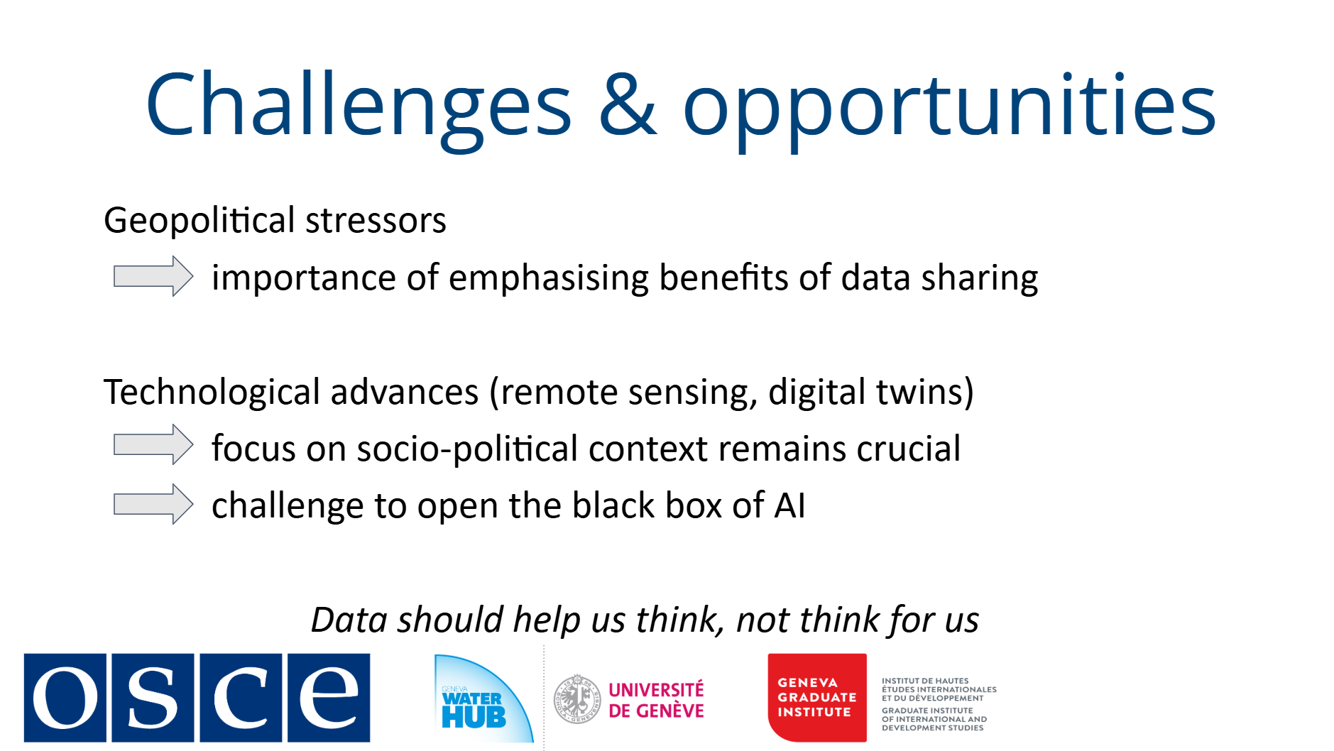
Moving forward, technology should augment, not replace, human judgment. Strengthening institutional capacity to assess risks, validate AI-driven insights, and integrate local knowledge remains essential. Balancing innovation with critical oversight ensures that digital advancements serve equitable and sustainable water management.
-
-
-
-
-
Students mustMark as done
1. An interview on trust, mistrust, data sharing and technological developments
This interview with researcher and practitioner Bota Sharipova offers valuable lessons for water policymakers, technical experts, and civil society working on transboundary cooperation. Her work uncovers a critical paradox: while water professionals in Central Asia maintain strong personal relationships, institutional distrust continues to block formal data sharing.
By comparing the Aral Sea and Sava River basins, Sharipova reveals how informal data exchanges between individuals fail to become systematic cooperation. In the Sava basin, joint projects built trust where none existed, while in Central Asia, initial trust collapsed due to political conflicts. Her research shows that sustainable data sharing requires institutional solutions, as automated monitoring systems face political barriers in upstream-downstream disputes over data sovereignty.
Bota Sharipova emphasizes that water professionals need both technical skills and political awareness, a challenge relevant worldwide. Ultimately, her findings demonstrate that trust is not just about personal connections but must be embedded in governance systems that ensure reliability, fairness, and long-term cooperation.
-
Students mustMark as done
4. An interview on practical examples from Central Asia on data sharing in water management
In this interview, researcher and practitioner Bota Sharipova shares insights on data and information exchange in transboundary water governance, drawing from her extensive work in Central Asia's Syr Darya River basin. She highlights how digital tools are transforming water data accessibility across multiple levels. At local scales, mobile applications like Uzbekistan's "Tomchi" and Kazakhstan's "Hydropost KZ" empower farmers and communities with real-time water information. Nationally, automated monitoring stations are replacing manual data collection, while bilateral initiatives between Uzbekistan-Kazakhstan and Uzbekistan-Tajikistan demonstrate growing regional cooperation in transboundary data sharing. Most strikingly, Sharipova uncovers how social dynamics influence data practices - where shared cultural ties foster informal exchanges, yet limited formal use of technologies like remote sensing in negotiations.
The Central Asian experience proves that effective transboundary data governance needs balancing technical innovation with political awareness and social trust. As digital tools advance, Sharipova's work reminds us that sustainable water cooperation depends on building systems that respect both hydrological realities and human relationships. For anyone working on transboundary waters, this interview reveals why some digital initiatives succeed while others stall, and how to design data systems that connect technical and political divides.
-
Students mustMark as done
This module has demonstrated that digital tools and water data management extend far beyond technical considerations, as they are deeply shaped by political, institutional, and social factors. Transparency in water governance must prioritize equity, inclusion, and accountability, as unequal access to technology, legal barriers, or lack of trust can exacerbate disparities rather than resolve them.
We examined how data collection and interpretation require collaborative development of monitoring standards and assessment frameworks to ensure legitimacy. While technological innovations from open-data platforms to AI-driven modelling offer transformative potential, their effectiveness depends on strong governance structures and human oversight to prevent misuse or marginalization.
Bota Sharipova’s insights reinforced that success hinges on trust-building, regional cooperation, and context-sensitive approaches. As you move forward, we encourage you to integrate these lessons into your work, balancing technological opportunities with inclusive, accountable water governance.
-
-
-
-
Students mustMark as done
Course conclusion
This course has explored how digitalization reshapes transboundary water management through data-driven cooperation. Thank you for joining us! We hope our course has provided valuable insights and practical knowledge to apply in your work!
Now you are invited to complete the final evaluation of the course!
-
-