Main content blocks
Section outline
-
-
Students mustMark as done
1. Presentation of key concepts and definitions
Welcome to this session on digital transformation in water governance!
In our interconnected world, technology is reshaping how rivers, lakes, and aquifers are shared. Today, we’ll explore core digital concepts that enable effective cross-border cooperation, turning raw data into tools for sustainability and conflict prevention.
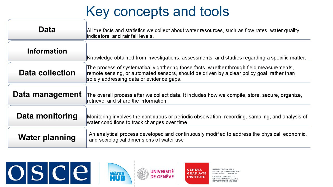
One of the key concepts in water governance is data, the foundation of all water decisions. In transboundary contexts, data means measurable facts, such as river flow rates, pollution levels, rainfall patterns collected through field sensors, satellites, or citizen reports. Digital tools now allow real-time gathering, but consistency is critical. For example, when neighboring countries calibrate sensors to the same standards, their shared datasets become actionable.
This leads to data management, the backbone of trust. Imagine a secure regional platform where countries store, update, and access hydrological information. Proper management prevents duplication (like redundant gauging stations) and ensures transparency. The end goal is to transform data into information: analyzed trends that reveal pollution sources or drought risks, often visualized through dashboards accessible to all stakeholders.
Continuous monitoring closes the loop. Automated alerts about sudden pollution spikes or floods enable rapid joint responses, averting crises. For instance, real-time nitrate readings in a shared river can prompt upstream farmers and downstream cities to collaborate on solutions.
These digital tools feed into broader governance. Good water management uses daily data to optimize reservoirs or reduce leaks, while water planning relies on long-term datasets to design climate-resilient policies and good water governance. Both depend on shared data to align local and national priorities with regional needs.
In this session we see how digitalization turns isolated measurements into collaborative solutions, be it tracking pollutants or planning dams. Yet technology alone is not enough. Success hinges on standardized methods, interoperable systems, and crucially, the willingness to cooperate.
-
Students mustMark as done
2. Importance of digitalization in the water sector and other sectors
60% of global transboundary basins still operate without joint agreements. Climate change intensifies regional water scarcity and pollution, and the occurrence of extreme weather events while outdated monitoring systems and lack of equitable cooperation frameworks hinder fair and effective water governance.
Digital transformation offers solutions to such a complex set of challenges. Platforms like the Sava River Basin Commission's Geographic Information System (GIS) system demonstrate how real-time data sharing can replace suspicion and mistrust with cooperation.
The Sava River Basin Commission (ISRBC) was established under the 2002 Framework Agreement on the Sava River Basin. It brings together Bosnia and Herzegovina, Croatia, Serbia, and Slovenia in a shared mission to ensure sustainable development, navigation safety, and flood control along the Sava River.
From its inception, the ISRBC has played a pivotal role in facilitating transboundary water cooperation. One of its core responsibilities is overseeing the exchange of hydrological, navigational, and legislative data among its member states, ensuring that decisions are based on accurate and up-to-date information. To streamline this process, the commission developed the Sava Geographic Information System (Sava GIS), a digital platform that integrates data on river conditions, flood risks, and environmental factors.
Over the years, the ISRBC has achieved significant milestones. With support from the European Union, the World Bank, and other partners, the commission enhanced its flood forecasting capabilities, bringing them in line with EU Floods Directive requirements. Beyond technical advancements, the ISRBC also prioritized the protection of cultural and historical heritage threatened by flooding, integrating these concerns into its risk management strategies.
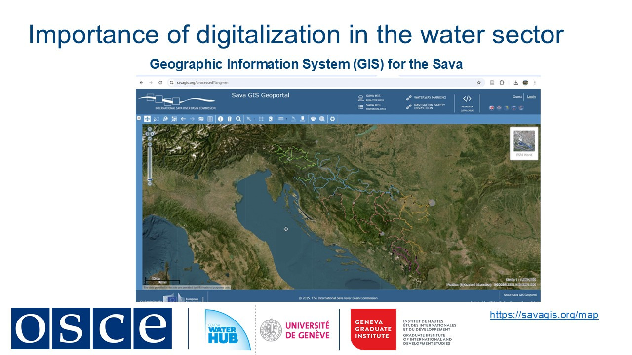
By combining policy coordination with digital tools, the ISRBC has not only improved water governance but also set an example for transboundary river management worldwide.
Other sectors offer valuable blueprints:
-
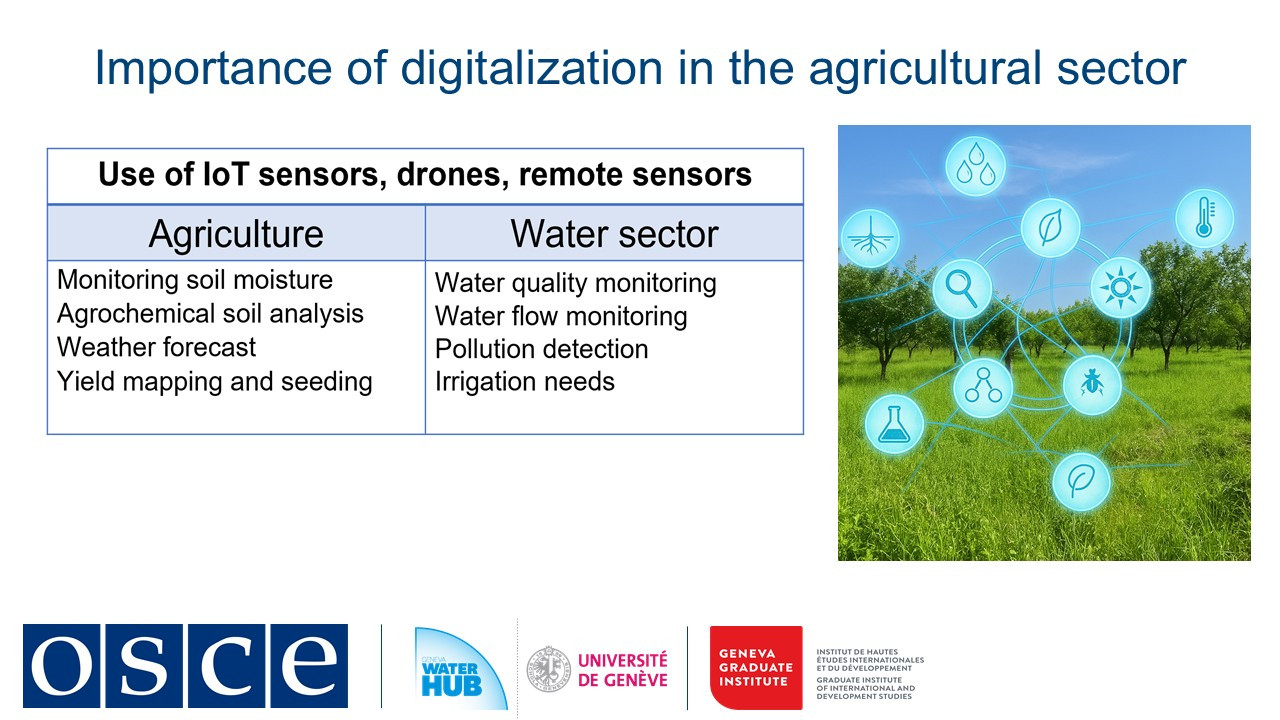
Agriculture: IoT soil sensors in Ukraine and Hungary could be adapted for basin-wide water monitoring
-
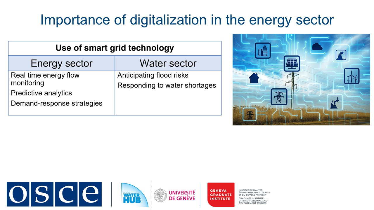
Energy: Estonia's smart grid analytics optimize water distribution like electricity flows
Digital early warning systems turn climate data into action by predicting glacier melt impacts or triggering SMS flood alerts. These tools make adaptation proactive rather than reactive.
Success requires pairing technology with diplomacy. By starting small, for instance, with a data-sharing memorandum or pilot warning system, countries can demonstrate cooperation's value. The OSCE's experience shows that when digital tools are embedded in trust-building frameworks, water becomes a bridge rather than a barrier between states.
-
-
Students mustMark as done
3. Importance of data and information exchange
Effective water management in shared river basins depends on one fundamental element: trust through data sharing. As highlighted by SDG indicator 6.5.2, routine data exchange is a prerequisite for meaningful cooperation rather than a technical formality (UNECE, 2024). When countries share hydrological, meteorological, and ecological information, they lay the groundwork for informed decision-making, emergency preparedness, and long-term resilience.
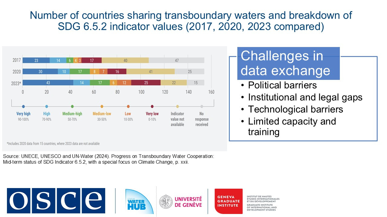
Yet significant challenges stand in the way. According to the 2023 SDG 6.5.2 assessment, three key obstacles persist: inadequate data, limited resources, and inconsistent information-sharing mechanisms. Without unified protocols, even the most advanced monitoring systems fall short.
Political hurdles further complicate cooperation. Upstream developments like dam construction and operation or excessive water withdrawals can trigger tensions with downstream neighbors, particularly where legal frameworks are weak or inexistent, as is the case in 60% of the world’s transboundary basins. Territorial disputes, historic grievances and competing interests often stall negotiations, proving that technical solutions alone cannot succeed without political commitment.
Technological barriers add another layer of complexity. Disparate monitoring systems, outdated infrastructure, and incompatible data standards hinder effective collaboration. In regions like Central Asia and Eastern Europe, gaps in real-time monitoring limit flood and drought response capabilities. Even when new technologies are introduced, capacity gaps often prevent their full utilization.
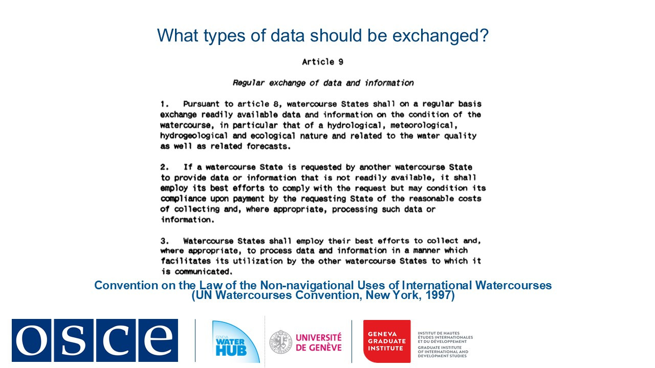
The UN Watercourses Convention provides guidance, emphasizing that "readily available data" should include hydrological, meteorological, and water quality information, shared at agreed intervals, whether monthly, annually, or in real time. This data must be accessible, standardized, and actionable. Socioeconomic indicators should also be included to ensure policies benefit local communities.
Successful examples, such as the Dniester River Basin (where Moldova and Ukraine exchange real-time data), demonstrate how digital systems can foster treaty development and flood coordination. Similarly, the Sava River Basin Commission has shown that GIS-based platforms can integrate diverse datasets, from flood risks to cultural heritage protection, into a unified decision-making framework.
It is clear that equitable transboundary water governance relies on transparency. By establishing straightforward data-sharing protocols, adopting interoperable technologies, and building trust, shared waters can become a source of stability. When countries prioritize accessible, standardized, and timely information, they transform rivers, lakes, and aquifers into drivers for regional cooperation and peace. By learning from successful models and committing to structured, needs-based data exchange, we can ensure that transboundary waters serve as instruments of collaboration for generations to come.
-
Students mustMark as done
4. Emerging trends in digitalization
As we stand at the crossroads of climate change and growing water scarcity, a quiet revolution is transforming how we manage this resource. In this session we track how digital technologies evolved from simple mapping tools to intelligent systems that predict floods and contribute for sustainable use of water.
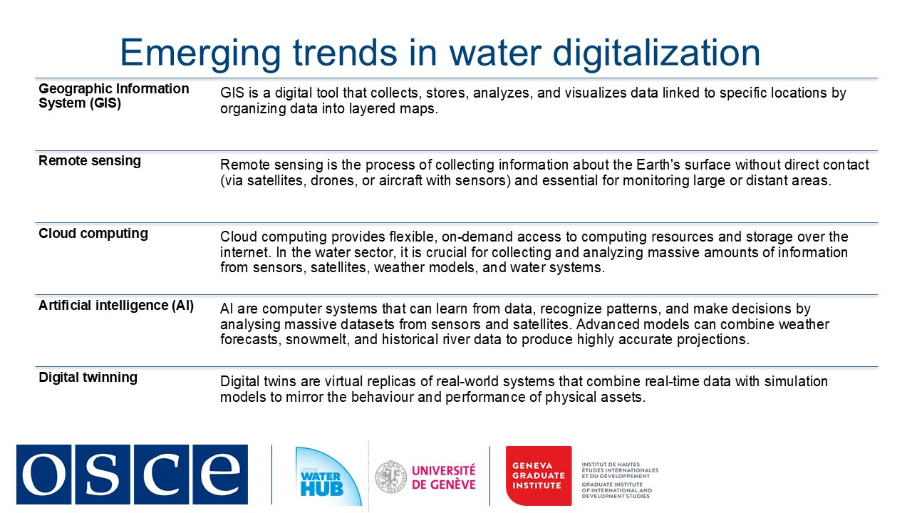
The last five years have seen great leaps in water technology. Artificial Intelligence now crunches massive datasets, such weather models, satellite feeds, and sensor networks, to forecast reservoir inflows with startling accuracy. Digital twins create virtual replicas of entire river basins where managers can simulate floods or test policy changes before implementing them in the physical world. In cities like Burgas, Bulgaria, AI-powered systems detect leaks in water networks almost instantly, saving millions of liters previously lost to aging infrastructure.
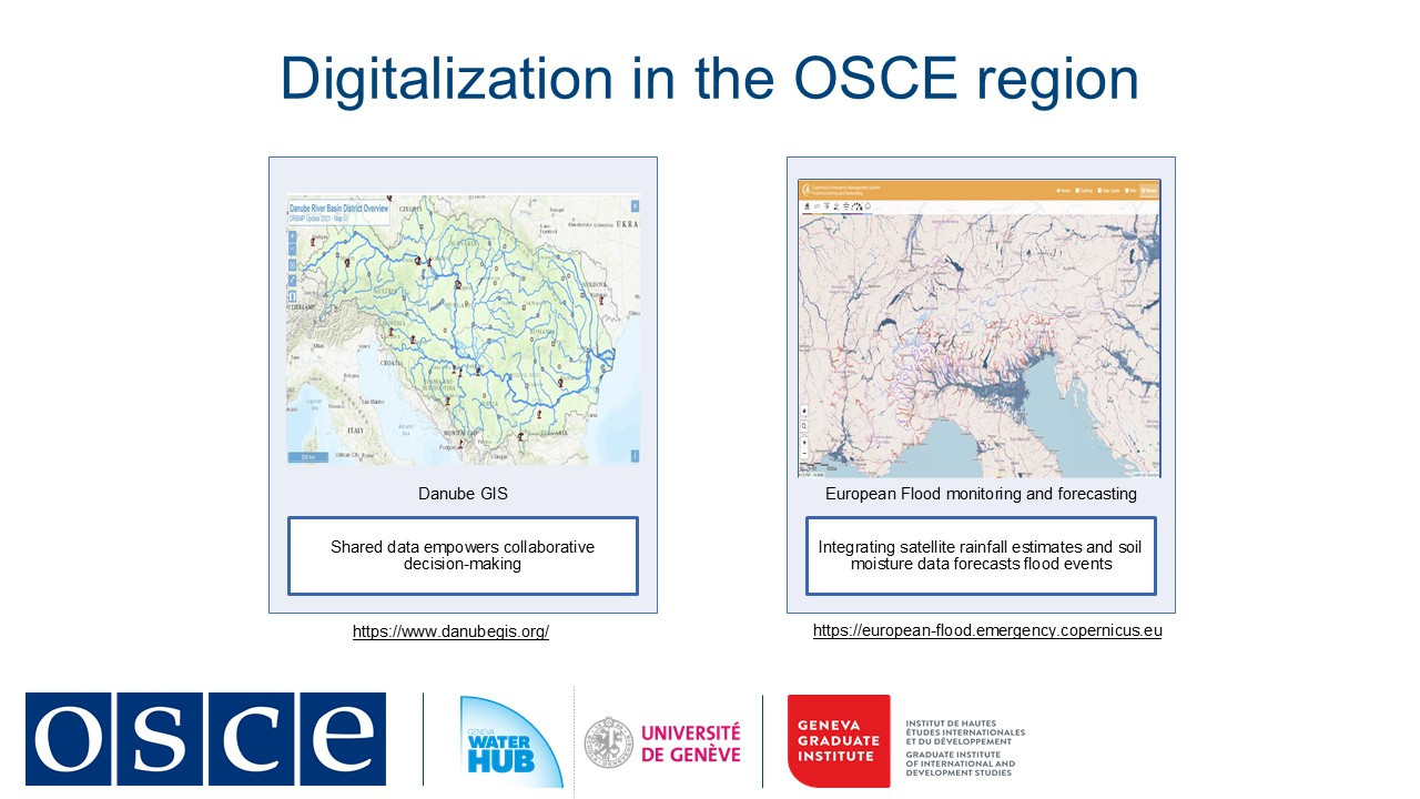
Perhaps most remarkably, these technologies are bridging political divides. Along the Danube River, the DanubeGIS platform allows 19 countries to share hydrological data transparently. In the Dniester Basin, Moldova and Ukraine collaborate through a joint geoportal that tracks water quality and flow regimes in real time.
Yet challenges remain. Many regions struggle with outdated monitoring equipment or lack technical capacity to harness these innovations. In addition, cybersecurity threats are present in increasingly connected water systems. And while satellites provide global coverage, ground data remains essential for calibration and validation.
The road ahead is both promising and demanding. As sensor costs plummet and AI grows more sophisticated, we are moving toward a future where every critical water point can be monitored in real time. But technology alone is not enough as we need stronger institutions, better training, and more inclusive governance to ensure these tools benefit all water users.
This digital transformation represents more than just technical progress. It's a new paradigm for water management: one where data becomes a common language between nations, where predictive systems help us adapt to climate change.
-